..(international youth festival Medjugorje)
Select language:..
SLO
ENG
HR
|
<<< Mladifest.com
- Medjugorje <<< ..(international youth festival Medjugorje) |
Select language:.. |
SLO |
ENG |
HR |
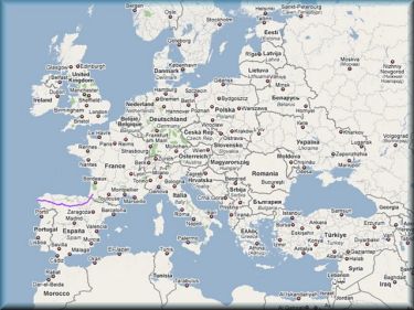
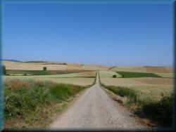
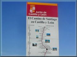
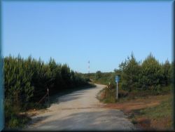
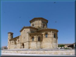
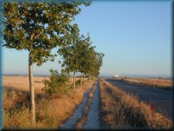
![]() Camino de Santiago de
compostela - route guide
Camino de Santiago de
compostela - route guide
![]()
Spanish St.
James's
Way - guide to the route
detailed
description of the pilgrimage route
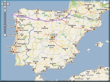
>>> Route description by days - route guide >>>
>>> Interactive map with pilgrimage route >>>
>>> Topographic map with pilgrimage route >>>
>>> Photos from St. James's route - Camino >>>
>>> Presentation of the route - Camino >>>
Description of St. James's pilgrimage route
Camino - Pilgrimage
to Santiago de compostela
is
one of the most famous pilgrimage routes in the world. It starts in the south of
France under the Pyrenees, not so far from Lourdes and
take s place through
the Pyrenees, then crosses Spain in the direction from east to west to the
Atlantic Ocean. People went on this pilgrimage route in the Middle Ages, then
not for a while, but lately this pilgrimage route has been visited en masse
again. Most pilgrims go on this route
on foot,
many also by bicycle
and some by horse. They start from different places, some from home and most
from Saint Jean Pied de port
in southern France, so this route is called the "French route" (Camino frances).
The basic route (Saint Jean pp - Santiago) is 816 kilometers long, but if we
continue to Finistere 905 and Muxia, 940 kilometers. This distance is not
entirely accurate and may be slightly different due to several variants on
individual sections (765 - 940). In addition to the French route, there are a
few other routes, that are less well known, e.g. the Portuguese route, the
Camino norte, the northern route, Primitivo, across the mainland..., which is
only visited by a small number of pilgrims. On this page is a description of the
most famous French route.
In Santiago de compostela is buried the
apostle Saint James, more about him:
Apostle James the
Great
was one of the twelve apostles and the brother of the apostle - the
evangelist John. Their parents were Zebedee and Salome (Mary's sister), so he
was a relative of Jesus. Jacob and John (along with their father) made a living
by fishing in Bethsaida on the Lake of Gennesaret, and in religious terms they
were disciples of John the Baptist.
Then Jesus invited them to join him, and they became his apostles. Together with
John and Peter, St. James had a special place next to Jesus (conversion on the
mountain). St. James spent many years in the territory of present-day Spain and
Portugal, where he preached the gospel. After the ascension of Jesus on
Pentecost, each apostle was assigned a land to preach the teachings of Jesus.
St. James was instructed to go proclaim "on the end of the world" - the Iberian
Peninsula. (At that time they did not yet know about America, etc.)
Once upon a time in the port of Muxia (our pilgrimage route is concluded here)
apostle James was supposed to be visited by Mary, who came here by merchant
ship. In this place is now a church in this memory. Because he was not very
successful in preaching on the Iberian Island, and at the invitation of Mary, he
returned to Judea in 40 AD.
James was the first apostle, who died a martyr's death : in 43 or 44, Herod
Agrippa had him imprisoned, flogged, and beheaded with a sword in Jerusalem.
After his death, two of his disciples transported his corpse by ship to Spain,
to the port of Padron (about 40 km southwest of Santiago) and then by land to
the place where Santiago de Compostela now lies, where he was buried. (Santiago
= Saint James). Then his grave was forgotten for a long time, and after the
liberation from the Moors, a church and a monastery were built there, and a city
grew around it.
In the Middle Ages, people from all over Europe began a pilgrimage to the tomb
of the apostles, and Santiago was one of the three main pilgrimage destinations,
along with Rome and the Holy Land. When the Holy Land was no longer accessible
due to the Crusades, Santiago gained even more power. Then the pilgrimages died
out for a few centuries, and recently, especially after 1989, when Pope John
Paul II visited this place, people are again leaving en masse on this pilgrimage
route.
This is today a well-known and important pilgrimage route for pilgrims from all
over Europe and elsewhere ...
James the Great celebrates on July 25 and is considered the patron saint of
pilgrims. That is why he is depicted as a pilgrim with the Holy Scriptures, a
cloak, a hat and a walking stick.
The reasons why
people take this route
are not
just religious. In fact, the pilgrims, who goes to the Camino (as this
pilgrimage is called) are only a minority for religious reasons. Those, who go
for religious reasons, have the opportunity to visit the Holy Mass every evening,
all the way, at least in larger places, and when have done, they go to the tomb
of the apostle James.
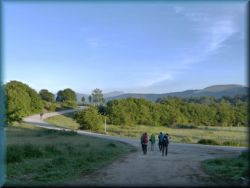
Most pilgrims go on a trip for various reasons: mainly the desire for change,
walking in nature, socializing with new people, losing weight, meeting new
places, sports, a little different vacation, and to avoid work, school, to avoid
crazy pace,... most of them for a little mixed reasons of all of them and all of
course voluntarily, somehow similar to why people go to the mountains... Many
people say. that you have to be a little “truncated” to walk almost 1,000km, but
no, pilgrims have, on average, a more "tidy attic" than most normal people.
Among the pilgrims are people of various religions, most of them are of course
Catholics, but there are also many
Evangelicals , some
Orthodox christians, Muslims and many atheists.
Pilgrims come from various
countries of the world: most of them are Italians, Spaniards, French, Germans,
Americans, Scandinavians, English, Portuguese ,
Poles
and South Koreans, a few Slovenes,
Croatians and here and there some Russian, Chinese, African, Bulgarian, Arab,
Australian, a Hungarian, ...
Regardless of where someone is from,
why he went on a trip and what position we has in society, pilgrims understands
each other well.
Pilgrimage or
tourism?
The pilgrimage is as
the pilgrim makes it himself. If someone will take the route more easily, that
is a little walking, little use of public transport, taking a lot of time for
various other activities and less for walking, visits to bars, then it is really
more and more touristy. In various printed guides for pilgrims, the route is
presented more in this form, especially "walking from town to town", ie spending
the night in a larger or smaller town, walking through the countryside and hills,
and then spending the night in a larger place again... so that on a pilgrimage
like this you fall right into a bigger crowd and it’s really getting more and
more touristy.
However, you can overlook these guides,
and walk a little differently: you spend the night somewhere in the country and
/or in the hills/mountains (where are also accommodations), then you go through
the cities and towns in the middle of the day (buy everything you need in the
store) and spend the night somewhere in the country. Such a pilgrimage is quite
different: you are often on the road alone, and meet only small groups or
individuals, those are real pilgrims. This way of pilgrimage is often chosen by
more experienced pilgrims - returnees. On the way, you are exactly a half of the
day away from the annoying crowds. Pilgrims walk along the path in a kind of
waves (in the morning a larger crowd starts from a larger town, and then are on
the way a few people all day, and so on). And even in smaller accommodations (pilgrimage
hostles) in the countryside, everything is different
![]() ,
as in cities. In the afternoon or evening, we can take a little walk in the
beautifull nature... And if you still follow a certain order, do not cheat when
walking, then this route is anything but not a tourism. We
can a beautifull experience
along the way, meet interesting people...
,
as in cities. In the afternoon or evening, we can take a little walk in the
beautifull nature... And if you still follow a certain order, do not cheat when
walking, then this route is anything but not a tourism. We
can a beautifull experience
along the way, meet interesting people...
Is this pilgrimage
supposed to change a person?
Many have already heard: that people are supposed to come back from this path
completely changed, different... Is that true? I don't think anything special,
you come back from the way
suchs as you went there, you are just a
few kilograms lighter
![]() .
.
However, while walking, you get used to
the fact, that the clock is not the most important thing in the world. You don’t
make any real plans about walking through the days and still get far, and
finally to the finish line, some day sooner or later. You become a true pilgrim
once you understand that the goal is not in the Santiago de compostela, but in
Saint Jean p.p. in France, the goal becomes your path itself. When you go on
such a journey several times, towards the end of the pilgrimage it becomes quite
close to you, because you know, that you will have to go home soon... You don't
feel it on the first pilgrimage, but with each subsequent one more and more.
With each subsequent pilgrimage, the pilgrimage seems shorter and the distances
shorter.
Description of the St. Jeams pilgrimage route - "Camino
de Santiago de compostela":
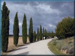
The first part of the route from Saint Jean France to Pamplona in Spain take
place
through the mountain world of the Pyrenees. Often in this part we are surprised
by bad weather, rain, fog, wind, mud, sometimes sun. The weather here is
changing fast. It may be cloudy in the valley and sunny in the Pyrenees. First
is a considerable ascent, and then a descent into the valley. The French
part of the Pyrenees is almost bare, without trees, overgrown only with grass,
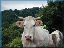
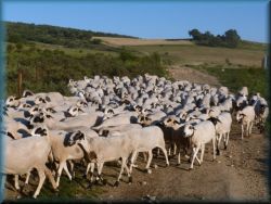
where are many pastures, lower are cows, and at higher elevation are sheep. On the
Spanish side, the Pyrenees are overgrown with dense oak forests. There are no
conifers.
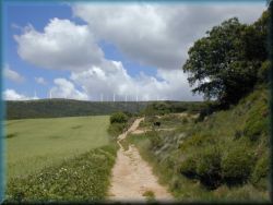
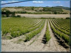
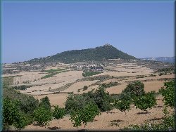
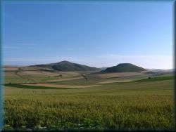
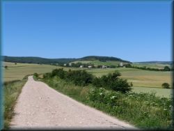
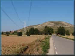
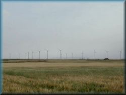
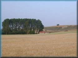
The second part of the route from Pamplona to Burgos take place through a hilly
landscape with many shorter ascents and descents, between villages and smaller
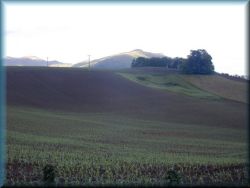
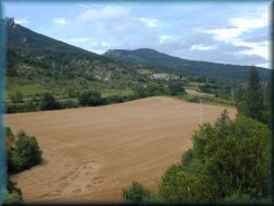
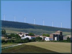
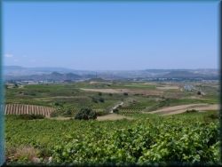
towns. The landscape is full of grain fields, vineyards and wind power plants. The weather in this part is usually nicer, sunny.
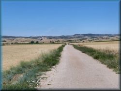
Third, the longest part of the route, from Burgos, via Leon to Astorga, take
place
mostly along the flat landscape - the Spanish Meseta, on elevation of 800-900 n/m. This is
not a perfect flat landscape, the landscape is always varied, full of grain fields,
lonely paths. According to some pilgrims, some of them traveled this part of the route,
or a part of this part of the route by train or by bus. It is a pity, because this
part of the route is the most beautiful, the most calm, there are no tourists.
The weather here is mostly nice and the hottest and driest.
The fourth part of the route from Astorga to Sarria take place over the mountain
world with some considerable ascents and descents. Especially on the mountains is
a beautiful, because there are full flowers and a beautiful view of the
neighboring mountains and hills and to the distant landscape.
The fifth part of the route from Sarria to Santiago take place through in a varied
landscape with hils an walleys. The weather here is quite changeable, humid,
it often rains or fog lingers, temperatures are significantly lower. In this part
of route is no
real calm anymore, because it is full of pilgrims - tourists (those,
who walk only the last 100km or 150, 200km of the route). Here, among the pilgrims, is
a competition for vacancies in accommodation, etc ...
The sixth part of the route from Santiago to Finisterre and Muxia is similar to
the previous part in terms of landscape and weather. But there is path again peaceful, because only a few pilgrims go to this part of the route, so there is no
crowd.
The first part of the route from the Pyrenees to Logronjo we walk in the
province of Navarre. It is the Basque part of Spain. The villages and towns are
full of flowers. The central and longest part of the route take place
through the province of Castilla. It is a hundreds of kilometers long flat
landscape on
the Meseta plateau, located at about 800 meters above sea level. In distant
history, here was once a large lake, this can be seen from the shape of
the rocks and soil (gravel, clay, lack of limestone). The last part of the
route take place through the province of Galicia, which descends towards the Atlantic
Ocean. The inhabitants of Galicia are of Celtic descent (relatives of the Irish
and Scots). This can be seen in the way it is built, and even more so in the
culture of the locals, especially the music. Pipes are a national symbol here,
and they play on them almost everywhere ...
How to get to the beginning of the rote and return to home?
First we have to reach Saint Jean pied de port, where begins our way.
It is a town under the Pyrenees in southern France.
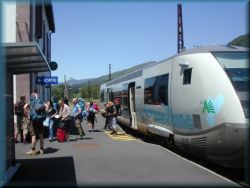
We have to get Biarritz Airport near the Bayonne and then continue by local
train for an hour to Saint Jean p.p.
However, we can also reach one of the other airports, up to 150 km away, which
are: Bordeaux, Pau, Lourdes and San Sebastian.
Return
home is similar.
Due to the lower cost of the plane, some people send their luggage home by mail.
It is more convenient for pilgrims from some parts of Europe to travel by bus or
by train.
How much does this trip cost us?
If we are a little more modest on the way, ie we spend the night in cheaper
pilgrimage accommodation, we mostly buy food in the store and choose cheaper
transport for the trip, the cost will be around 1,000 € for pilgrims from west
and central Europe, but for pilgrims from elsewhere, must be added additional
transport costs. We carry some money with us, but we pick up most of it at
ATMs along the way. All debit and credit cards work at ATMs (Maestro, Mastercard,
Visa, American express, etc ...).
How long have to walking?
The main route from Saint Jean p.p. to Santiago is 765 to 816 km long (in some
parts we can choose a subvariants, so the distances are a little different),
which we cross in 20 to 26 days. Then an additional 5 to 6 days to Finistere and
Muxia, and a few days to stay in Santiago. One month all together and few days
to return home. Every day we walk an average of 25 to 35 kilometers.
What to we take on the trip?
As little as possible, all together a maximum of 10
kilograms. Exactly what we really need: a backpack, two sets of light clothes
(one we wear and the other we wash), a sleeping bag, toiletries, phone and
charger, bank card, some money, passport, small plastic dish and cutlery fot
preparation of salad, raincoat and small umbrella, thinner jacket (this also
applies in summer!), anorak, buttons for drying clothes (about 5 pieces), pencil,
hat or cap, suncreme, sunglasses, patches for blisters, small knife, needle and
thread, 1 liter plastic bottle for water, inconvenient insurance is also
recommended. Hiking poles are not needed, because the path is quite easy
and safe.
Accommodation for pilgrims
Pilgrimage accommodation in pilgrimage hostels for overnight stays
intended exclusively for pilgrims on this route, who meet the conditions for
them. They have a subsidized price, no sojourn tax, pilgrims sleep in
larger rooms, with multiple bunk beds, as in the mountain lodges. We have
toilets, showers, and in some places kitchens or restaurants too. Somewhere we
sleep on pillows on the floor.
Pilgrimage hostels is called in Spanish "Albergue de peregrino" or in French "Refuxio
de pelerin". They are divided into:
- parish owned, their label is Parroisial (these are the best: we
usually have there common dinner, sometimes breakfast and we pay a voluntary
contribution)
- state-municipal owned, their label is Municipal or ACAG (here
we get only accommodation, shower, but not food, in some places is a kitchen for
individual use, they are cheap)
- private, those have different labels (are most expensive, usually have a
restaurant)
There are special rules in these accommodations: we can only be in each of them
for one night, then we have to move on. In the evening we have go to bed no
later than 10 pm, and the next morning we have to go on the way no later than 8
am. Clothes we mostly washed by hand, and in some places it is possible to wash
in the washing machine and / or dryer at an additional cost. Most of the
bedrooms have bunk beds, where we have to use a sleeping bag.
When to go on a trip?
The Camino is walked on flat landscape, in cities, in the countryside, on the hills,
on the mountains and at the ocean. For ordinary pilgrims, who are not looking for any special
conditions, it is best to go for easier walking, when is no snow in the
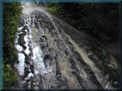
mountains, when is less rain, because the path in the rain is too muddy,
not too hot and not too crowded. The best times are late spring, late summer and
early fall. It is too early, especially in the Pyrenees, for winter and snow,
followed by the rainy season, especially in the first part of the route,
followed by a fairly dry period, which is most suitable for walking. In the
middle of summer is heat and a big crowd, followed by a suitable period
again and finally a rainy autumn with short, cold days and winter that are not
suitable for the trip. The best time to go, is the second part of May and most
of June and then the second part of August and the first part of September. It
is completely inappropriate, however, to go on a journey from late October to
early April.
According to some data, the footpath across the Pyrenees is closed from 1
November to 31 March. This rules was chosen because there were too many
accidents among pilgrims at that time. At that time, it is only possible to go
from Saint Jean p.p.
to the Spain by road, which goes through the valley and across the Ibanjeta pass.
![]()
Route map
Route
description by days - route guide
(if it doesn't
show you all the pictures, but only the blank squares, press the F5 key in the
top row)
1.) Arrival in Saint
Jean pied de port:
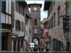
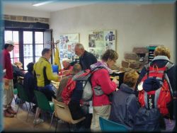
When you get
to the station by bus or by train, go up on a wide street to the old town and climb
on
the stairs to a narrow street and up to the top, where on the left side is a pilgrimage office. Usually several pilgrims are
on the
station, and you just follow them to the office :). If it is currently closed, we
wait a bit, or. we look at the schedule. (every day: 7:30 - 12:00, 13:30 -
20:15, and Fri + Sun: 21:30 - 23:00). Inside is a long table, at which
sits
officials. We have to fill the form, and they give us various instructions about
the route, especially across the Pyrenees, we receive a pilgrimage passport (booklet) -
"Credencial de Peregrino", in which we collect stamps on the way, and with it we
can go to a pilgrimage hostels. In addition, we get a list of
pilgrimage hostels, some directions, etc.
Attention:
Due to all possible frauds in walking
(bus, renting taxis,…), which are used by some pilgrims, we now require, that we have at least two
stamps for each day we are on the way in the pilgrimage book - one from the
pilgrimage hostel
and more one from the other, eg. from a church, bar or checkpoint
along the way. Maybe someone will say, “what about me, since I’m not going on a
trip because of a certificate or stamps ...” But that’s not entirely true. When
you go on this trip, you have to accept certain rules and if you follow them,
you also receive some benefits subsidized by the EU, ie you are exempt from
tourist taxes, tax-free accommodation, subsidizing pilgrimage accommodation,
arranging the route itself, in some places discounts for pilgrims menus,... Therefore, this control has been considerably tightened recently, especially in
the last part of the route and even more in the direction to Finisterre and Muxia. However,
not all of these subsidies are intended for traditional tourism, where the full
price with all taxes must be paid everywhere. Anyone who would like to be a
tourist, should go to a hotel.
Pilgrimage hostels are accommodation intended exclusively for pilgrims on this
route, that meet the conditions for them.
They have a subsidized price, no tourist tax, and pilgrims sleeps in a larger
rooms, with more beds, much like in the mountain lodges.
They have toilets, showers, and in some places kitchens or restaurants.
Pilgrimage hostels are named in spanish "Albergue de peregrino" or in french "Refuxio
de pelerin".
When we do these things, we can find
accommodation for today, because we usually go on a trip tomorrow morning.
In the town
is enough accommodation, but we can go to the "municipal" (state-based)
pilgrimage hostel,
which is a little higher on the same street, almost at the city gate (Rua
Citadelle 55). If here is no more free places, then we go to someone else on the same
street backward, down. If we arrive in Saint Jean p.p. late in the afternoon, we have
to book accommodation by phone or internet in advance. In the afternoon we buy
food for tomorrow, see the town, go to church, etc. If we are lucky that the
Holy Mass is in the church on this day, we can go to the Holy Mass in the evening
(at 18:30), after the Mass, there is a blessing of the pilgrims. In France (and
whole Europe) is a
shortage of priests, so there is no mass every day, because several
parishes share one priest. But if we arrive in Saint
Jean pp in the morning, as soon as we finish at the pilgrimage office, we can
already go on the way to the first accommodation in the Pyrenees: Orrison or to
Roncesvalles.
2.) Route
across the Pyrenees - (Saint Jean pied de port - Pamplona)
In this part
of the route are a large number of pilgrims on the route. often a
long column of pilgrims is drawn from Saint Jean pp towards the Pyrenees, and
even later quite a few people are on the way. The weather in the Pyrenees
changes quickly, and often on the top is shrouded in fog. It can be dangerous
during storms.
We get up at
6am in the morning, get breakfast at the hostel, meet other pilgrims, who usually
come from all over the world... and then we go down on the street, past the church,
over the bridge and through the city gates (Spanish Gate). ). Here’s the
fork in the route: we usually go left along the “Napoleon footpath,” which goes
across the Pyrenees. (in case of very bad weather, storms or snow, we can go
right here along the road that goes along the valley to the Ibanjeta pass, and
further along the road to Roncesvalles, where is a monastery and a larger
pilgrimage hostel.
Route across
the Pyrenees: We
leave Saint Jean pp at the city gate "Spanish Gate" and look at the signs,
or
we follow the other pilgrims. In the beginning, the rote climbs rapidly
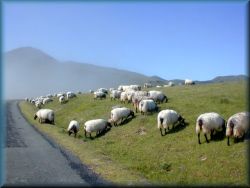
along the asphalt road past individual farms. Along the route are pastures, where
cows graze.
Over a time, the road becomes slightly
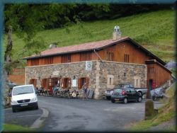
flatter. After about two hours, we reach the bar and the first accommodation along the way -
pilgrimage hostel Orrison, which is also the last building to the top. If you
plan to spend the night here, it is advisable to book in advance on tel. +33 63
826 97 38. Accommodation there is not too cheap, but we also get dinner and breakfast.
We continue along the winding asphalt
road. There is often a fog, but if there is not, than is a
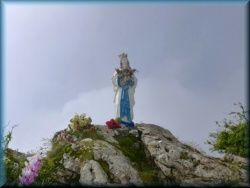
beautiful view to the valley and to the peaks of Pyrenees. After a while, we see
a statue of Mary's statue slightly to the left of the road. Often at this
elevation
we get out of the fog, if it is foggy, or vice versa... In the higher part of
the path are sheep on pastures instead of cows, also here the landscape is
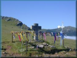
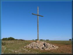
completely bare - no trees or shrubs, only grass grows. We finally reach thr Cross on right side of the road.
Here we leave
the road and go right, climb up on a steep footpath. Often in this part the
route
is quite muddy. After a short ascent, we reach the top, where are unusual
large stone cubes. We soon reach a fence with barbed wire on the right (this is
the border between France and Spain). We soon reach a well, where we can pour
water, and immediately after it, we go through the rest of the gate in the fence
and we are already in Spain. From here we go through the oak forest to a small
house, which now serves as an emergency shelter in case of a storm. From here is only a short ascent to the top. If the weather is nice, is a nice
view to the neighboring peaks, back and forth into the lowland. But can be
fog, cold, rain and wind here. We are at an altitude of about 1,600 n/m. The
descent to the Spanish side follows.
Here the
route
splits into two parts, and we choose the path that we think is more suitable for
us,
and after both we come to Roncesvalles - a small village with a large monastery
on the Pyrenees: in the left direction the route descends steeply through an oak
forest to the aforementioned village. This route is shorter and is
recommended in nice, dry weather. In the rain, however, it is dangerous to walk here
and the right direction is more appropriate, which goes along a gentle wide footpath
to the Ibanjeta pass, where we come to a chapel on the road, that coming from the
direction of France. Another 2 kilometers of descent along a gentle asphalt road
and we reach Roncesvalles. From here to Santiago is 790 km. Roncesvalles
is a small village at an altitude of about 1,200m.
In the monastery
are two bars with a
restaurant and a larger new pilgrimage hostel, but here
is no shop. According to the new law, it is desirable to book accommodation
and, if desired, dinner / breakfast in advance on the Internet:
http://alberguederoncesvalles.com/
Every evening is a Holly mass and blessing of pilgrims in the monastery
church. Below the road is a larger old building, that was a barn and
until a few years ago served as a pilgrimage hostel. If we want to have dinner
in one of the restaurants, it is necessary to book it a few hours in advance or even
better at the same time as accommodation on the Internet. For the pilgrimage
menu, the price is € 11, but you get two dishes: usually pasta macaroni or mixed salad
and potatoes with meat or fish, dessert and good Spanish wine. Different
combinations are possible. Dinner is after the Holy Mass.
We leave
Roncesvalles along the road and follow the footpath through the woods to the next
village of Burgete, followed by Espinal and Bizkareta (Spanish Viscarette).
These are smaller medieval villages on the Pyrenees with narrow streets
and a church. Here are pilgrimage hostels (Espinal)
and shops (Burgette, Viscarrete - Bizkareta). The route descends through
deciduous forests, which consist mainly of oak and various shrubs. In case of
bad weather, this part of the route is very muddy and it is better to go where
is
possible along the road, which in mostlx not so far from the route.
We are in the Basque region of Navarre,
where the names of the villages sometimes have quite unusual names, as well as
various combinations of the letters T, Z, K, X, B and bilingual signs.
The houses in
this part are richly decorated with flowers.
We reach the valley at the small town of
Zubiri, which lies along the main road leading to Pamplona. Here are
a few pilgrimage hostels and shops. A little further from the town is a large
asphalt factory on the right side.
From here we follow on the footpaths with
several smaller ascents and descents over the hills, near the river, through
the valley to the larger town of Pamplona, 25 km away. On the
route to
Pamplona
are a few smaller
places with pilgrimage accommodation, especially in the village of Larrasoanja,
which is the first next, followed by Zuriain, which is near the bridge over the
river and Zabaldika, which is a good choice if you want to avoid
spending the night in the city Pamplona. Zabaldika is a small village on a hill,
in solitude,
about 10 kilometers before Pamplona. There is one of the better parish
hostels,
otherwise on a hill, about a kilometer out of the way. The valley descends
towards Pamplona, and our route goes not far from the road, and crosses it a
few times.
We get to the suburbs of Pamplona over an
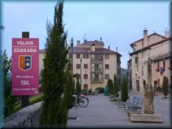
arched bridge in Arre, followed by Villava and Burlada, which are quite a decent
independent town, but all the way to the real Pamplona, which has about
150,000 inhabitants. In Villava, of course, in addition to other offers, there
is also a pilgrimage hostel. After a few kilometers of walking around the
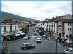
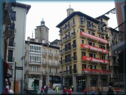
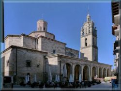
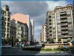
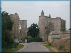
city, we come to a city in the ancient city walls on a hill - this is Pamplona.
Pamplona is a larger city, known mainly for bullfights and the annual running of
people in front of wild bulls through the city streets. They run this race every
year on the feast of St. Fermin, from July 7, followed by various events until
July 14. If we are on a pilgrimage here at this time, we can also
attend this ... But no one guarantees us that we will stay whole, nor that we
will stay alive. Every year, some are injured and sometimes even dead. Therefore,
on this day, all pilgrimage hostels in Pamplona are closed as a precaution to
keep as few people as possible. Saint Fermin was born in Pamplona in the third
century.
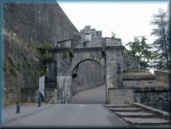
We enter Pamplona through the city walls
in the city door with a well-preserved mechanism. We come into the old town with
narrow streets. Among other things, the city has several churches, full of shops
and pilgrimage
hostels. The Cathedral is
open to the visitors,
where you have to pay an entrance fee to enter, except at the time of Holy Mass.
We leave the
city through the park.
3.) The hilly
landscape of Navarre (Pamplona - Burgos)
We finally
left the last remnant of the Pyrenees behind and we continue in the wavy and hilly landscape of
Navarre and La Rioja begins with smaller hills all the route to a long plateau
called Meseta in the central Spain. The landscape here is sown with many grain
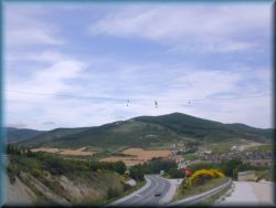
fields, vineyards, and the hills are full of wind power plants to produce electricity.
This part of Spain produces the good red wine - "vino tinto". This wine is
strong, slightly sweet and, despite overdoing it, does not cause any health
problems.

We leave the
Pamplona through the park and partly along the road, partly along the footpath to
the nearby village of Cizur Menjor, where on the left side is a small castle with a
monastery of Maltese monks, who also have a pilgrimage hostel.
From here we go left along a footpath that
climbs towards a ridge full of wind powerplants. The ascent is laid first, and from the
village of Zariquiegui onwards it is steeper. In case of bad weather, this part
of the route can be very muddy, occasionally there are also minor landslides.

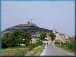
After about an hour and a half we reach
the top of the "Alto de perdon", where is a monument of pilgrims. It is a
life-size column carved from iron slabs by pilgrims on foot, on horseback and on
donkeys. From here is the last look back to Pamplona and then look
forward to the endless landscape, all sown with grain fields. Often
here is quite windy.

We descend to
the other side along a footpath among the bushes into the valley, and then along a
fairly flat section through the smaller villages of Uterga, Muruzabal and Obanos.
The first two villages are smaller, with only one street of cramped houses on
each side, and Obanos is slightly larger with a mighty church in the center.
There are also shops and pilgrimage hostel.
Then we
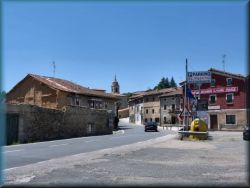
descend to the road, and reach a larger town - Puente la Reina. The town lies
along a larger river, and was named after a large arched bridge over the river
at the exit of the town. The town is medieval with narrow streets. There are
several pilgrimage hostels, shops, churches and bars. We are in one of the part
of route with the lowest elevation. In Puente la Reina, a
large number of pilgrims usually stay, also because this place is often chosen
by pilgrims cyclists for the first night to stop. In the compact center is
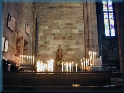
also the church of St. James, where every evening is a pilgrimage Mass.
If you want
to stay here overnight and want a quieter place, you can go a little outside the
city, a kilometer further, over the bridge and immediately right on the hill to the
pilgrimage hostel on seclusion, (hostel Santiago apostol)
Puente la
Reina we leave over a large arched bridge, turn left and walk for a while along
a wide valley, followed by a steep short ascent through a pine grove to the
highway N-120. We reach the smaller village of Maneru, and from here,
along a flat footpath, planted with vineyards and grain fields to the larger village of
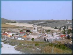
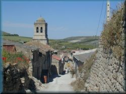
Cirauqui. Cirauqui is one of the most typical Spanish villages in this part of
the country - on a hill together sloping mushroom-shaped village with a church on
the top. In this part of Spain do not have individual houses, as in another countries in Europe. A bigger village, almost a smaller town,
then at least 5 kilometers of nothing, then again a bigger settlement on a hill
- this is the Spanish countryside. Older people live in Spanish villages, there
are almost no young people, children are a wery rare ...


Cirauqui is a
small town on a hill, where is a shop and a
pilgrimage hostel with restaurant. This village is quite secluded and only a
small number of pilgrims stay here (no tourism), so this is a good choice for
overnight stays. From here, route descends slightly along a fairly good
macadam road into the valley. A special water viaduct is built over the valley
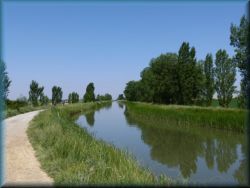
to irrigate the fields. All these fields in this part of the country have
regulated irrigation, so the landscape is interspersed with numerous irrigation
canals, pipes and artificial rivers.
Route follows through the rather undulating landscape
and through the villages of Lorca and
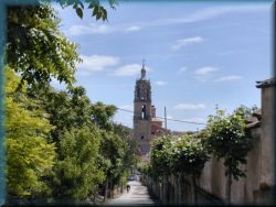
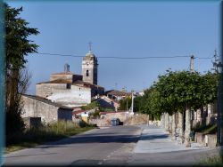
Villatuerta to the larger town of Estella. Estella is a larger town by the river,
and has an older and newer part. We enter into the older, medieval part of town.
Right at the entrance to the town is on the left Church of the Twelve
Apostles, and above is a characteristic large rock.
We continue along a narrow street, past a pilgrimage hostel on the left. Stairs lead from the
central square to the church of St. Peter. This church has an even larger
monastery and beautiful colored windows, and every evening is there a Holy Mass
for pilgrims.

We continue
along a narrow street to the newer part of the town, which is nothing special,
it is similar to all other modern towns.
We continue
our way up to a slight hill and descend to the road, followed by a small climb to
Irache. Somewhere in the middle of the ascent is a larger monastery, and on it
are two taps intended for pilgrims: one for water, the other for wine. The wine
is free here, you just pour a glass (or a bottle :) and drink. It is true, that
only about 0.5 dl of wine flows at a time, but if you are persistent and turn
the tap here and there for a while ...
![]()
This is
followed by a short ascent, then is a fork: left to a footpath, that goes mostly
through the forest and uninhabited countryside to the town of Los Arcos or right
through a more open countryside through a few smaller villages to Los Arcos
where the routes merge. There is no major difference between them in length.
- If we turn
left, route rises quite steeply into a nearby hill at the beginning. We walk through
a dense forest, then along a macadam road through an uninhabited landscape. In the
summer heat, this choice is more suitable because of the shade, because most of
the way we walk through the forest, and some also through open clearings. After
about two hours, route descends into the valley, to the village of Louquin,
where is a small pilgrimage hostel, and then goes further down in the valley,
between fields of olives, vineyards and grain fields, where it joins with the right path leading
to the town of Los Arcos.

- If we turn
to the right route, it climbs some time through a rather undulating
landscape between woods and vineyards. Followed by a small village Azqueta, a
little later we come to an arched medieval fountain, and after a kilometer to
the village on a hill - Villamayor de Monjardin. Here are two smaller pilgrimage
hostels and shop. If it is already late, it is advisable to stay here overnight,
because it is 10 kilometers to the next place, and in this place is one of
the better pilgrimage accommodations, hostel Hogar Monjardin, runs by an evangelical
family from the Netherlands. In the evening we have a common dinner, to which we
are invited with a bell, followed by a common prayer and reading of texts from
bible. Each
pilgrim gets a little booklet with a collection of gospels in their own language.
The place here is pleasant and on a hill with a beautiful view of the surroundings.
There is a church in the village, which is rather modest inside, and the Holy
Mass is only exceptional here.
From here, route descends along a
maze of foothpaths through the valley to the town of Los Arcos, 10 kilometers away.
It is a larger medieval town with several shops, a large church and more pilgrimage
hostels. As there are more major pilgrimage accommodations here, it is more
crowded and everything becomes too touristy (disturbing).

Route continues along
the footpath in the flat
landscape between
the grain fields, in the middle of nowhere, there is no houses, no road, no trees
in the entire field of view. After less than two hours, we come to a slight hill,
where two villages are grouped together: Sansol and Torres del Rio, separated by
a semi-dry remnant of a water stream. There are several pilgrimage hostels, shops and
bars in these two villages, especially in Torres del Rio.
From here,
the landscape is quite undulating, followed by minor ascents and descents along
footpaths between fields of vineyards, grain fields, small pine forests and uncultivated land.
After less than three hours of walking, we reach the road and follow on the footpath
near the road to the town of Viana. Just before
the townl on the right side is an unusual red sand hill, which is probably the fruit
of human machines.
Town of
Viana is located on a slight hill, and at the top is a church with a special
pointed tower.
In the town are three pilgrimage hostels, one of which is
the parish one, which is next to the church. Here pilgrims sleep on the
floor on pillows, in the evening we go to the Holy Mass together, and after the
Mass we have a common dinner, which is also attended by a friendly priest, who
then shows us the church, which is a real work of art.
The town is
medieval, with narrow streets, with no major newer part, except this one on the right
before we enter into the town.
From here
follows a slight three-hour descent to the next larger modern city, Logroño,
which lies along a larger river, in the middle of which is a small islet. We
leave the province of Navarre and enter the province of La Rioja (which means
“the red one”). The soil and stones here are red, due to the large amount of
iron in the soil, which is good for producing a good wine.
Logroño is a
great new and modern city, the capital of the province of La Rioja. Here they
have a large number of pilgrimage hostels, shops and more, otherwise the city
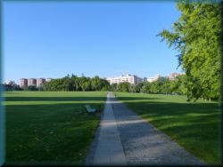
is nothing special. We leave Logronjo through the park and follow the wide paved
promenade to the lake. Usually, this part is full of people, especially locals
and tourists who go for recreation.
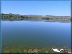
We come to a
larger lake full of fish, ducks and other waterfowl. There is a piny grove by the
lake, where various events, picnics, weddings, etc. take place.
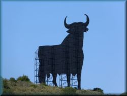
From the
lake, our route rises over a slight hill and along the macadam road next to the highway
to the small town of Navarette. Just before Navarette, to the left on the hill
is a large black iron bull that haunts the surroundings. In Spain, the bull is a
sacred animal, so they have several such monuments in the hills. Just before the
town are the ruins of an old pilgrimage church.
We continue
across the highway and arrive in Navarette. Navarette is a small town on a hill,
with several pilgrimage hostels and shops, otherwise is nothing special. Due to the
larger number of hostels, more crowds are expected here.
Route continues to slight climb along a
macadam road near the highway to a small village on the hill - Ventosa. Again one of the
typical smaller Spanish villages: at the top reigns a church, below one or two
streets of houses leaning together. There is also a pleasant small pilgrimage
hostel, which has its own food store and kitchen, where everyone can
prepare their own dinner. In the inner courtyard of the hostel is a small
aquarium with running water and chairs to rest on the sun. There is a beautiful
calm in the village and because it is on a hill, is a beautiful view to
the wider surroundings from here, especially from the church. Definitely a
better choice for the rest of the afternoon and overnight stay than the previous
Navarrete or the next Najera...

From here, route slowly descends along
foothpaths abd macadam roads between fields of vineyards and grain fields towards the town
Najera. The soil and stones are distinctly red in this part. In the valley we
go through a few smaller villages to the town of Najera, which lies by the river.
The peculiarity of this town is the high red stone wall that rises behind the
town. This wall is full of carved cavities in which cave-people once lived.
Access to the caves is closed. Otherwise, this part of Spain was already
inhabited 40,000 years ago, more on that below. The town of Najera is a tourist
town, everywhere is full of tourists, noise is everywhere, here is full of various
restaurants, hotels, shops, churches and several pilgrimage hostels. The prices
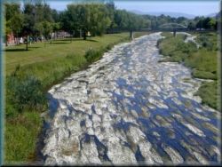
in bars and restaurants are also quite touristy here - higher. A river flows through the
town,
which is so clean that millions of tiny water flowers bloom in it at a certain
time (the second half of June). Then the whole surface of the river turns into a
white flowering carpet. The main "municipal" hostel, at least according
to my findings, is not in the best condition here, so I do not recommend it too
much, because after six kilometers, the following hostel
where is much better... In the church of St. Cruz is a Holy mass every
evening.

From Najera, route path rises steeply
along the macadam road, at
first through a pine grove, and then along the plain between the grain fields
to Azofra, 6 km away. It is a small village with a pleasant pilgrimage hostel.
From here, ourm route climbs slightly
between the grain fields, and after ten kilometers we come to a completely newly
built small town - Ciruenja. In 2008, this town was still being built, but now
this town is vacated. The state built this town, like several other similar
towns
in Spain, completely on new, in the middle of the fields in the countryside, in the
hope, that people would settle here, but they are miscalculated. Almost all the houses are
still for sale, and there are no buyers who would like to come and live in this
town.
The town is exemplary: a few streets of terraced houses of this shape, a few
streets a little different, a street of small apartment blocks, parking, central
center with children's playgrounds, swimming pool, golf course, shopping and
catering facilities, a new road to the city ... but all is empty... Still, they
keep everything well together. People here, and especially young people, are not
interested to live in remote places, they prefer to live in big cities...
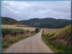
Route continues along a macadam road and
footpaths, through a
wavy landscape between endless grain fields. After a good hour and a half we
arrive in the town of Santo Domingo de la Calzada. The town lies along a semi-dry
wide river channel, for almost all the water from the river is used to
irrigate the fields. There are several shops and two larger pilgrimage hostels. A special feature of the city is the church,
or. two
churches next to each other. In the right church, they have a live cock in a
cage, which they replace it with a new one, when it wears out.
Entry to this church is only possible if you pay the entrance fee. As for the
cock in the church, there is a story: Once upon a time, a family stopped in
this place on a pilgrimage to Santiago. The son was wrongly charged with theft
and the judge sentenced him to be hanged. The son was hanged, but he survived
the hanging. The mother goes to the judge and tells him that her son is still
alive, and the judge said, "that her son is alive as that roasted cock on the
plate" he was just eating. At that moment, the cock on his plate came to life and
took off. The judge saw this and forgave the son and they were able to continue
on their way. Since then, they have a live cock in cage in this
church. We leave the town over a long bridge over a semi-dry riverbed. There is
a chapel at the beginning of the bridge.
Route
climbs slightly along the macadam road to the cross by the path and after less
than two hours of walk, we reach the village of Granjon. It is a larger village with one
street of compact houses and the Church of St. John the Baptist.

There are a few shops and two
pilgrimage hostels. Of particular note is the parish hostel, which is in the
church tower. In my estimation, this is one of the best pilgrimage accommodations on the
entire route. We sleeps on pillows on the floor in the attic of the
church, in the evening we go to the Holy Mass together, after Mass we together prepare
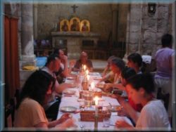
dinner, set the tables and have common dinner.
Mostly young people spend the night here. After dinner, is socializing with music (and
wine) in the park behind the church...
Granjon is the last settlement in the
province of La Rioja, and then we enter to the largest Spanish province of Castile
(Castilla y Leon), which is divided into several provinces.
Our route continues through a rather
undulating landscape, through smaller villages, between grain fields, but in
general trail climbs slightly all the way towards the Meseta plateau, which
occupies a large part of northern Spain. After less than twenty kilometers, we
come to the town of Belorado, where are a large number of
pilgrimage hostels and shops. The ruins of the old castle rise above the town,
and the open church towers are full of storks' nests. From here, the church
towers are mostly open in smaller settlements - only a wall with lintels for bells.
The ringing of such bells is not as it should be...
Town is small
and we continue along a macadam road through a wide valley, through
smaller villages. It is especially worth mentioning the first such village -
Tosantos. A special feature of this village is a small church in a stone wall
right above the village. Here reigns the Queen of the Mountain (La Virgen de la
penja). That church is carved into the rock, but even the locals do not knowm
when it was built. There is another church in the center of the village. Every
spring is a procession here, when a Mary (statue) is brought from that
church in the wall to the church in the village, and in the autumn she is carried
back in a procession to the mountain, where she lives in winter. In
Tosantos is a smaller, pleasant pilgrimage hostel (a branch
of the Granjon hostel), managed by the Italians, in the afternoon we
visit this pilgrimage church on the mountain together and there they tell us
something about that church.
In the
evening we prepare dinner and have common dinner. To prepare dinner together,
as in many other places, means to: wash and slice vegetables, prepare salad,
prepare plates and utensils, drink and prepare tables and chairs where necessary.
After dinner we put everything away and wash. Usually, however, we are not
allowed to go to the stove in these cases, but this is done by the hostel manager and
his assistant, if he has one, and any of the older pilgrims.
After dinner
we have a common prayer in the chapel in the attic, during the prayer we read
the requests written by a pilgrims from our place in the past days, and then we
write our own, which will be read by the pilgrims behind us. Every pilgrim here
also gets a badge on his hat in the shape of a yellow arrow.
Such joint
activities are usually only in smaller, remote and, above all, parish hostels. In doing so, the pilgrims quickly get to know each other and
socialize. This is not the case in large and city hostels. The worst thing is, if
you are left alone in a crowd of people. In larger hostels, but especially in
cities, accommodations are just "sleeping boxes", after arrival and quick
completion of formalities, you get a number of bunk bed, and no one cares
about you until you leave… You don't even know who is your neighbor on the the
nearest bunk bed… All of this is an approximate picture from everyday life when
comparing people in rural and urban areas.
In addition,
a good and especially warm dinner after a full day of walking is even more
important, that you not eat only dry food from the store or expensive,
inappropriate and, above all, too small portions in restaurants every day...
Route
continues through the valley,
through smaller villages to Villafranca montes de oca. This is a
larger village along a very occupated road, especially this road is full of trucks
and trucks trailers, that sometimes it is quite a problem to cross the road, or to
live here permanently ... There is a shop in the village, two larger pilgrimage
hostels and a church. Here it is good place to pour some more water, buy food, because 12
kilometers will be nothing now, and the path will be quite strenuous.

At the church we turn right and follow on the
steep footpath up into the oak forest. The climb is quite long. At the top we come
to a plateau overgrown with a sparse pine forest and numerous wind powerplants. This is followed by a short descent into the valley and again an
immediate ascent back. Then about two hours of walking along a fairly wide level
path - clearings in the middle of the forest. In case of bad weather, the path
here can be quite muddy. A short laid descent to the village of San Juan de
Ortega follows.
San Juan de
Ortega is a small village at an elevation of about 1,200 n / m. Here is the church,
in which is a larger tomb of St. John, a disciple
of St. Dominic, is buried. Every evening is a pilgrimage Holy Mass, and
all pilgrims gets a special iron cross from St. John with a ribbon around their
necks, which we wear until the end of the pilgrimage. About 100 meters away is a
small pleasant pilgrimage hostel, where every pilgrim who stays here
overnight gets a free garlic soup, and for an additional fee also dinner, which we eat
together at the table in the evening. The accommodation is really a bit older,
but very pleasant because it is not to much crowded.
We continue
our way through a small grove, and then is descend to the basin, where is the small
village Ages. The village is nothing special, but there are several
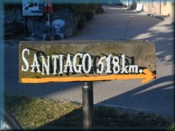
pilgrimage hostels. From here is is only 518km to Santiago...
We continue
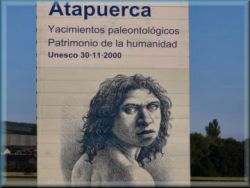
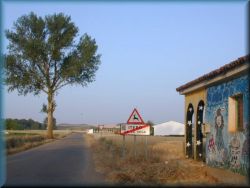
along the road to the smaller, half-abandoned village of Atapuerca. Before the village,
is a large board depicting a caveman (Neanderthal). In this place, more precisely in the cave Yacimientos (about a kilometer to the
right) they found the oldest human remains in Europe, estimated to be from
40,000 years ago. There is a museum now. Just before the entrance to the
village, are some remains of statues on the left. The village of Atapuerca
is nothing special, it has one or two a pilgrimage hostels, a shop, bar and church,
and most of the other houses are empty, people have moved out. If we are here
overnight, we can go in the afternoon to the church, where is a nice, quiet
place
to rest with a nice view to the wider surroundings.
At the end of
the village we leave the road and go left past the sheepfold up a rather steep
and rocky footpath. At the top we come to a wooden cross, followed by a short walk
along a flat plateau, and on the left is a military training ground fenced
with barbed wire. Shortly before descending into the valley, a beautiful view
opens up to the endless plateau of Mezeta, which lies at an elevation of just
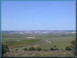
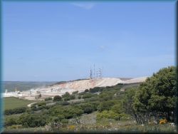
over 800n / m and is about 400 kilometers long. Below right is a quarry, and in
the distance is the large city of Burgos. If we have binoculars, you can also
see the Burgos cathedral towers from here...
Then we descend into the valley, then initially along
foothpaths and
later along the asphalt road we continue through two smaller villages:
Cardanuela riopico and Orbanea Riopico, where are more bars and pilgrimage hostels, the last before Burgos. We continue along the road to the airport (as
soon as we get across the highway), and there is a fork, so we can choose two options: to go
straight, around the airport to the main city entrance and along it to the
center of Burgos. This route is more strenuous because it is an hour and a half
walk along a heavily trafficked asphalt road through a densely populated (also very hot
in summer) city. However, you can go at the airport (as soon as you
cross the highway) to the left along the foothpaths, through the fields, forest and park almost to
the city center. This route is a slightly
longer and more difficult to navigate (because there are no signs), but more
beautiful because we avoid city noise, heat and traffic...
Otherwise, in
the city of Burgos, the pilgrimage route is poorly marked, the signs are
blurred, covered and if you do not have a good map or navigation device, it is
quite difficult. The easiest way to find your way around the Cathedral is to get
there. Only a few steps away are pilgrimage hostels and everything else, that
pilgrim needs.
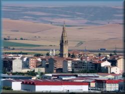
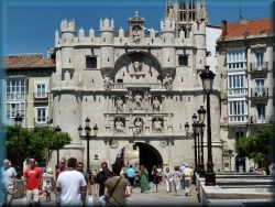
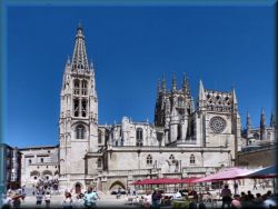
Burgos is
big a city, and has a population of 200,000. A special
feature of the city is the Cathedral. Just looking at it from the outside is
something special. We can get a stamp here. To see the interior, you have to pay
an entrance fee during the day, except in the evening, when is a
pilgrimage Holy Mass, when there is no entrance fee. Otherwise, the city center
is lively, there is always something going on. Pilgrimage hostels are in the
immediate vicinity and are modern, but is noisy here.
4.) Plateau
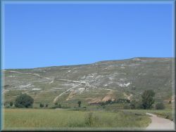
"Mezeta" - endless flat landscape (Burgos - Leon - Astorga)
So far we
have walked mostly on a hilly and wavy world, but now we are on a more
or less endless flat lansdscape. There are also some minor ascents and descents, but
are only a few, hardly worth mentioning. The landscape here is quite different.
There are almost no trees left, let alone any forests. There are also no more
vineyards. They are just endless grain fields. The weather is drier in this
part and hotter in summer. But this part of the route is the most beautiful,
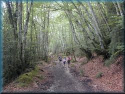
there are fewer pilgrimsan no tourists on the route.
We have to
quite
walk again to leave the city of Burgos and continue along
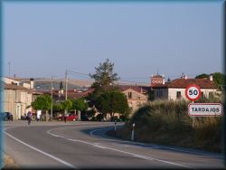
the zig-zag paths across the fields to the village of Tardajos,
10 kilometers away and a few kilometers further, a little higher, a village of
Rabe. A good choice for accommodation for those, who would like to avoid staying
in the city of Burgos.
From here,
route climbs slightly but steadily to the plateau. After a few hours we reach
a basin in which is the smaller village of Hornillos. The village is small, and crowded
with pilgrims, due to the large number of hostels.
Therefore, if is possible, we walk another 6 kilometers to the next place Sam Bol.
After a short ascent, we continue on a
perfectly flat plateau between many wind powerplants. After an hour and a half
we reach the next basin, where a small pilgrimage hostel Sambol is
located on the left next to a small forest. This is again one of the best
hostel, we have a candlelit common dinner here, because they don't have
electricity here.
After a
further two hours of walking we reach the basin in which lies the small village
of Hontanas. Here are several pilgrimage hostels and one shop. From here, route descends along the
footpath into the valley to the road, which leads to the
ruins of
half-destroyed church of St. Anthony, through which the road take
place. In this
remnant of the church is a small pilgrimage hostel, also without
electricity, and if there is a drought also without water ... Otherwise, this
accommodation is very pleasant, we also get common dinner, and the contributions are
voluntary.
We continue along the level asphalt road along the
tree-lined avenue to the small town of Castrojeriz, 4 kilometers away. A little
before the town is on the right a church, and on the hill above the town are
ruins of old castle. The town is nothing special, but there is a larger number of pilgrimage
hostels, if we want to stay here overnight, we go to the state - municipal
hostel, named of San Esteban, which is above the main square. However, here is more crowding
and noisy... If we do not intend to stay here, we can go past the town
along the "bypass" road (we continue straight along the road we came on),
because the pilgrimage route rejoins the road at the other end of the town. At the
end of the town at the crossroads, turn left from the road onto the footpath towards
a small hill. When we reach the hill, a kilometer of steep ascent to the
top awaits us. At the top is a resting place and a beautiful view to the wider
surroundings.
The descent
to the other side follows, the view to "infinity" opens. In all of vision
from here, is only one endless grain field, through which our route leads, there
are no buildings, no
roads, no trees, only in the distance at the end of the horizon you can see the
river, to wich we have to go ... We go down to the other side and continue walking
through this endless field. After a more than hour, we reach a resting place by the
fountain, and a little further on is the road. Followed by a short walk along
the road, then we turn left towards the river. A bridge was built over the Pisuerga
River, which is the border river between the province of Burgos and Palencia.
The river has a perfectly appropriate name because it is quite polluted.
Just before
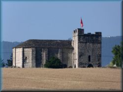
the bridge, on the left is a church without a tower, which now houses a small
pilgrimage hostel - Puente San Nicolas. This is one of the better
accommodations and is run by Italians. We have a common candlelight dinner (there
is no electricity), a common prayer and a special ritual of washing the
feet. Following the example of Jesus, the manager of the hostel washes the feet of
every pilgrim. In fact, it's getting simpler... Here we get breakfast the next morning,
and we set off around half past seven in the morning.
First we
cross the river and along the macadam roads between the fields to the villages of Itero
de la vega and Bocadilla and continue along the artificial river towards the
town of Fromista. We walk near a wide artificial irrigation
canal, which take place above the surrounding plain with many pumps, valves and gates
all the way to the town of Fromista. The town of Fromista is a small town, not so
far from Palencia and is the most southern point of our pilgrimage route. There
are several shops, some pilgrimage hostels and the Church of St.
Martin, but you have to pay an entrance fee to enter it, although there is
nothing special ... At the exit of the town is a special negative shaped statue
of a pilgrim (basically an iron plate and a pilgrim-shaped opening carved
in it.)

We continue along thefootpath
near the road. Here, the path is crossed in several places by
tiny paths of ants, so we have to be careful not to walk to them too much. After a
few kilometers we reach the village of Poblacion de campos, where the pilgrimage
route splits into two parts: the left part continues near the road, or the right
near the almost dry bed of a larger river. After a few
kilometers, the paths merge again, but it is recommended to go straight to the
left path at the road.

After a good
hour we arrive in the small village of Villarmentero del campos. At the
beginning of the village is a very special pilgrimage hostel "Amancer".
In my opinion, this is again one of the best accommodations along the way,
especially for those who like something unusual and like to experience something
along the way. We are received by a friendly manager (who cooks excellently,
among other things), we have a choice of a normal bunk bed and a limited number
of places in bungalows, sewer pipes and a tent and some even in hanging bags on
the trees ... everything is placed on a large garden in the Indian style, and (non-dangerous)
domestic animals roam freely around the accommodation: donkeys, chickens,
cocks, ducks, dogs, even domesticated chickens. If we are here in
the middle of the afternoon, then I recommend that we finish walking here for
today...

As part of the accommodation is a
large garden - a park where is a camp with a tent, but if you have your
own tent, you can set it up here. We have common dinner together at a long table.
Dinner
is so plentiful and varied that you can hardly believe it. A kitchen is also
available for pilgrims. The administrator has already walked the pilgrimage
route several times and in the evening he has a lecture in English with good
advice on the further route. In addition to all this simplicity, the
accommodation has all the modern things that a pilgrim needs on the way, hot
water for washing, showers, bar, wifi, ... In addition, mostly young pilgrims spends the night here.
We continue,
and after an hour of walking on the footpath near the flat road we reach the
next village Villalcazar de sirga. There is a larger church, in
which is a white Mary (Maria la Blanca) in the altair, to enter the church
you have to pay an entrance fee, except in the evening when is the pilgrimage Holy
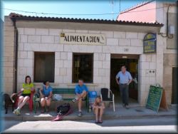
Mass, entrace is free. There is an even smaller pilgrimage hostel and shop.
After an hour and a half of further
walking along the route, we reach the larger town of Carrion. Before entering
the town, a fresco of a "frightened pilgrim" is painted on the wall of the
church (which has faded in recent years). A pilgrim with unusually large eyes is
drawn. There are three major pilgrimage hostels, because a large number
of pilgrims usually spends the night here, especially a lot of cyclists, so it is
quite crowded here. In the center of town is the Church of St.Mary, and next to
the bottom right of the monastery is one of the better pilgrimage hostel of the
same name. In front of the church is a larger platform, and above it is Mary on
a pillar. Every evening is a pilgrimage Mass in this church, followed by
the blessing of the pilgrims. Every pilgrim gets a pilgrim star. Prayers follow
with a song led by white Augustinian nuns from the local convent, which are
beautifully singing and playing on the guitar. The peculiarity of this town is, among other
things, the incredible crowd of little birds on the sky, flying here and there.
It is advisable to get a little more food and water here, because it
is 18 kilometers to the next
settlement.

We continue our way through the old town
and when we come out of the town, an endless flat landscape begins, in the beginning
is still full of
grain
fields, and finally there are no more of them.
We walk on a good macadam road, along which are some resting places for
pilgrims with wooden benches.
After a
four hours of walking in the middle of nowhere, we see a small church in the
distance, on the right. Here the route descends into a basin in which is the small
village of Calzadilla de la Cueza. Right at the beginning of the village we
notice a larger building on which is a blue fresco of a pilgrim with a stick,
that
resting. Here is a pilgrimage hostel, or two now, in this
one with the fresco is a small inner courtyard for an afternoon rest in
the sun with a small swiming pool. Anyone staying overnight at this hostel, has
a special discount at a pilgrimage dinner in a nearby restaurant. In the
neighbour is also a shop
and restaurant mentioned earlier.
We finally
got halfway from Saint Jean pp to Santiago!
From here,
the route take place through a rather undulating landscape, followed by the villages
of Ledigos and Terradillos de los templarios. Just before Terradillos, in the middle of the
grain field, is a pilgrimage hostel with a
restaurant, and in the village center is another one, more modest. Every
evening is a pilgrimage Holy Mass in English in the village church. In
this part of cuntry, the houses are often built of brick and unplastered, so all the
villages look kind of red.
Route
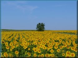
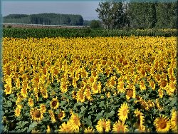
continues along footpaths between fields of flowering sunflowers and grain
fields, through two smaller villages of Moratinos and San Nicolas. Here, from
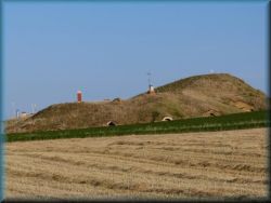
Moratinos to Leon, some people lived in some kind of underground houses, the house is buried in the ground, only the facade is outside and chimneys
protrude from the ground. Some of these cottages can be seen in the begining
just befor the
village of Moratinos and a little later along the way.

Following the
slightly longer part of the route to the town of Sahagun. A little before the
town, we come to a small church, and a little further are two statues.
These statues marks a half of the Spanish part of the pilgrimage route from
Roncesvalles to Santiago (for those of us, who started in France, this is not the
case). The town of Sahagun is nothing special, but it has more shops and
pilgrimage hostels, bars, etc..
From the town we continue on the footpath
near the highway to the village of Calzada del Coto, 5 kilometers away. Shortly
before the highway junction, the pilgrimage route splits into two parts: the
longer, right part goes over the highway to the small village Calzada del.Coto,
where is a small pilgrimage hostel and continues through a minor ascent
through the village of Hermanillos and joins the basic pilgrimage route again in
the town of Mansilla de las Mulas.
The basic, left part of the pilgrimage
route continues on foothpath, not so far from the highway and railway, and
stretches in the same image for a more, than 30 kilometers. Although quite close to
major roads, this foothpath is arranged in a way that, gives pilgrims a sense of solitude.
Along the entire path, a series of small trees were planted in 2007, which to
this day have grown into already quite decent trees and give pilgrims quite
decent shade on the way. The path is almost completely flat with a few gentle
turns. In between are a few smaller villages. It is worth mentioning
Bercianos, where is a shop and two smaller pilgrimage hostels, especially
the parish one is one of the best hostels on the whole way. This hostel can accommodate up to
20 pilgrims, most on bunks in the attic, the rest on pillows. In the evening we
help the manager prepare common dinner, then have a dinner, and a common prayer,
then we
go together to watch the beautiful sunset.
The next village along the way is El burgo
raneiro, which is a compact street of red houses and an interesting church at
the end of this street. After three hours we arrive in the village of Reliegos,
where are several major pilgrimage hostels, bars and a shop. Just before
the village are again some underground houses. As a curiosity, we
first notice the bar with a blue painted facade, and even inside all the
walls are painted and drawn by pilgrims. In that bar you can get a decent
dinner (on one plate) together with wine for a good price 6 - 8 €. Usually a large group of
young people from nearby hostels gather here in the evening, common dinner is at a long
table, and there is enough wine ... According to the latest data (2019), this
bar was closed ... But there is another bar right next to it, only, but that there
are no such benefits...
Our route
still continues along a tree-lined footpath up to an hour and a half walk to the town of Mansilla de las Mulas. We go into the
town over the overpass,
over the highway. Town is smaller, except for shops and pilgrimage hostels, there is nothing special. The landscape is changing
dramatically here. If we walked
to now
on quiet, secluded paths,
from now all
the way to the town of Leon, which is 20 kilometers away, we will walk on a
foothpaths and road
along a heavily busy road. Somewhere in the middle of this distance, behind the
village of Puente villarente, the path rises slightly to the right above the
industrial suburb of Leon. Before entering the city of Leon, we cross a blue,
iron zig-zag bridge over the highway.
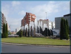
The city of
Leon has about 150,000 inhabitants.
Entering a newer part of the city that is nothing special is exactly the same as
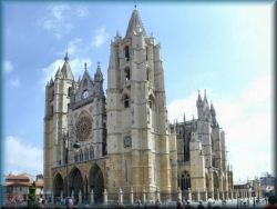
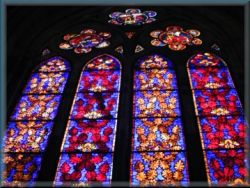
all modern cities elsewhere. In the old part of city is the Cathedral, famous
for its colorful windows. Entrance to the Cathedral is possible only at certain
hours and if you pay the entrance fee. In the evening, when there is a
pilgrim Holy Mass, admission is free.
In the old part of the city are several other historic
buildings. Leon is full of shops and several
pilgrimage hostels, as a larger number of pilgrims usually stop here to
overnight. One of
the worst pilgrimage hostel along the way is the Cistercian one, where they
invented some very rules of their own: pilgrims are separated by sex in the
lodgings, and even then they are constantly strived for various little things in
their bedrooms.
It takes us a long time to leave this big city and after a short climb past the
underground houses we come to the larger village of La Virgen del Camino. In
fact, almost everything sticks together with the city of Leon.
When we leave the village of La Virgen, we come to a fork where the pilgrimage
route splits into two parts: the left, 10km longer part goes mostly through
solitude and sparsely populated area, between fields and through a few smaller
villages to the larger village Hospital de Orbigo. The right, shorter
path along a fairly busy road, and through larger settlements to the village
Hospital de Orbigo, where the paths merge. If we have enough time, we definitely
go on the left, a longer, but nicer path.
- On the left,
10 km longer part, we go along the foothpaths and along a fairly trafic-free
asphalt road to an hour's
walk to the small village of Oncina de valdoncina, which counts only a few houses, where
is a small pilgrimage hostel, where we also get food (common dinner and
breakfast). Since the place is quite secluded, and on a small hill, we have a
nice opportunity for short walks for the rest on the afternoon on the
surrounding footpaths and meadows.
In the village is also an abandoned church and a (functioning)
bar.
From here,
our route ascends slightly to the plateau, then an hour's walk along a foothpath
without settlements to a smaller village, where you come to a
fairly trafic-free
asphalt road, and
another one hour of walk is to the larger village of Villar de Mazarife. There
are two major pilgrimage hostels, a shop and an bar.
It is
followed by a two-hour walk on an almost traffic-free asphalt road between fields of
corn, sunflowers and grain fields to the next village, Villavante, where is also
a small pilgrimage hostel and a shop. Following next hour of walk along the path, and we
arrive to the larger village Hospital del orbigo.
- On the right, 10 km shorter route, we
soon reach a fairly busy road and through smaller
villages (San Miguel, Villadangos, San Martin) it is quite a few hours of boring
walking on the plain to the 25 km distant Hospital del Orbigo. There
are several pilgrimage hostels and shops in these smaller villages. Along the
way, we notice a change on this part of route for the first time in a long time: a larger
mountain range appears in the distance, which means that in two days our endless
flat landscape will be over, then we will climb on to the mountains... Although this variant of the
route is shorter, it is quite strenuous due to heavy traffic on the road.
Just before the larger village of Hospital
del Orbigo, on the left is the Seat car factory, and at the entrance to the
village is an orange water tower. A special feature of this village is the 750
meter long arched stone bridge over the river Orbigo. The river is not so wide.
Here are several pilgrimage hostels, shops and bars. It is worth
mentioning the parish pilgrimage hostel "Karl Leistner", which has a smaller green inner
courtyard.
Immediately
after leaving the village, the pilgrimage route splits: left on foothpath near the road to the city Astorga, 20 kilometers away, and
a right on foothpaths between the fields and over the hill also to Astorga. It is
recommended to go on to the right path, to the nearby small village Villares de
Orbigo and a to next
Santibanjez valdeiglesias, where are also smaller pilgrimage hostels and bar. From here,
footpath climbs on to a small hill overgrown with forest, and some quite time we walk through a quiet and secluded landscape to the top. At the top
we come to some almost completely dilapidated building, where we can buy soft
drinks, in pigrim passport we can get a stamp in the shape of a red heart. In addition,
here is a pilgrimage accommodation "more 1000 ***" (possibility of sleeping
outdoors). Of course, there is no water or electricity, you have to bring food
for dinner...
After a short
walk along the plain, we come to a concrete cross, and a view opens up to a city Astorga, which lies on a hill on the other side of a smaller
valley.
We descend
into the valley to the village of San Justo de la vega, which is basically
already a suburb of Astorga. If we are lucky, the aromas from a nearby pig farm
make our way a little more difficult. We cross the railway line over a green
zig-zag iron bridge, similar to the one in Leon across the highway. A steep
ascent to the city center follows.
In the city are several major pilgrimage hostels
and several shops. Astorga is a compact medieval city and has about
15,000 inhabitants.
In the center of city is a large square,
where are
often various markets, and a little further on is a special beautiful castle
designed by Gaudi (he also designed the famous Sagrada Familia church in
Barcelona). This castle now serves as the diocesan palace. Next to the castle is
a larger church - the cathedral, which is nothing special.
5.) Mountain
world (Astorga - Ponferrada - Sarria)
The flat landscape
is over, now we will climb to the mountains to the Iron Cross, then is a
steep descent into the valley, two days of walking through the valley, followed
by a steep ascent to the mountains again and descent into the countryside of Galicia.
When we leave Astorga, follows an hour of
walking along the plain to the small village of Murrias. Here we finally
say "goodbye" to this endless flat landscape, we have been walking on for a quite time.
As soon as we leave the village, route begins to climb slowly. After five
kilometers we come to the medieval mountain village of Santa Catalina. This is a
street of compact stone houses, and in the middle of the village is a church
with a typical open tower, as they have in this wider part of the countryside.
In the village are two pilgrimage hostels and shop.
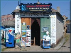
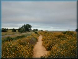
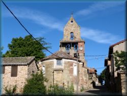
After the next five kilometers of gentle
walking on footpath, we come to the next village El Ganso, which is uninhabited. At the
beginning of the village is the bar "Cowboy". A little bit later is a smaller
pilgrimage hostel shop and bar. The other houses here are
empty and visibly decaying, as is the church too. Although is a road through
the village and it is not so far to the city, people from these mountain villages have moved
away. Probably a similar fate awaits many other Spanish villages sooner or later,
because on the rural areas living mostly elderly people. We walking on the
foothpath, near the road for a while, then we turn onto a steep footpath, that climbs through
the forest to the village of Rabanal del Camino. It is a larger, compact,
medieval, still living mountain village on a steep slope. It has a large number
of pilgrimage hostels and shops. Special mention should be made of the
accommodation next to the shop, which offers accommodation in the garden in
tents. A large number of pilgrims usually stop in the village for overnight.
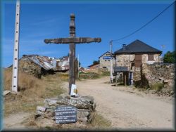
From here we climb mostly along footpaths
through the forest and through open clearings to the next mountain village
Foncebadon at an elevation of 1,500 n /m. Foncebadon counts only a few houses, but
there is also a shop / bar and a few smaller pilgrimage hostels. Special mention
should be made to the parish hostel in the old abandoned church at the
end of the village. They have bunk beds and pillows on the
floor. In the evening we have a common prayer and a common dinner, which we
prepare together earlier. In the hostel is also a chapel. Because this village is on so high elevation, it’s not hot here. A special feature of the village is the
round, stone-covered house at the beginning of the village, this is a museum
example of construction in these mountains in the past. Along the way we will
see a few more such houses, including one on a Cebreiro.

We continue on an open clearing with a
beautiful view to the valley and the neighboring peaks, and the path is full of
fragrant yellow flowers, if we are on the path at the right time. The path climbs
slowly to the road, and finally, after a few
bends we reach the iron cross (Cruz del ferro), which is the highest point of
our pilgrimage route. Here stands a small iron Cross on a wooden pole,
surrounded by a large pile of stones that is still growing slowly but steadily.
Every pilgrim was supposed to bring a small pebble from home or elsewhere, and
put it next to the Cross. Pilgrims sometimes drop off some equipment, that they no longer need
it on the way and put it at the
cross, Next to
the cross is an abandoned chapel.
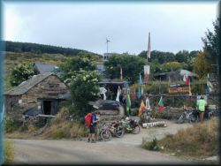
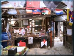
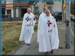
From here, our route descends slightly along the
footpath, near the trafic-free road to about a
half-hour walk to the small wooden decaying house - pilgrimage hostel Manjarin, which is something
special. On the outside we notice, that this is a larger wooden hut, or.
a set of barracks of rather poor appearance. In front of the entrance is a
sign indicating the distance to various important places on the world, and at
the entrance are a lot of colorful flags from different
countries, brought here by pilgrims. If we don't
plan to spend the night here, we can only go inside, to get a stamp and buy
something in the souvenir shop. (among other things, they have nice postcards with a
donkey). But we can stay here overnight. This pilgrimage hostel doesn`t have
electricity, and according to some unverified information, here is also a
common
dinner, and the accommodation is not too clean. It is run by the Templar
monks of Ponferrada, where they have their center in the Templar castle. In
Spain, unlike most of the rest of Europe, the Templar Order of Monks is still
active, but they are no longer soldiers, but to some extent a mysterious order
of (un)consecrated monks with white monk's frocks, and they have special crosses on
them. Their job is to help the pilgrims on this st.James's way (they maintain some
pilgrimage hostels). Their single functioning monastery in Europe is in the Templar Castle
in Ponferrada.
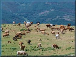

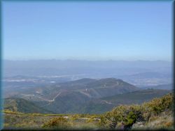
We continue
along the foothpaths through pastures overgrowned with shrubs, yellow flowers and through
a sparse deciduous forest. The path
slightly
climbs to the next peak with
an abandoned transmitter tower. Here opens a beautiful view further into the
valley and to the neighboring peaks of this mountain range. In the distance we see
the large city of Ponferrada and the nuclear power plant there, with two large
cooling towers. After about an hour of moderate descent with a beautiful view,
we arrive in a compact medieval, mountain village with black roofs and special
built-in balconies: El Acebo. In the front of entrance to the village is a board
with the inscription in Spanish: "Welcome to the province of Bierzo". This
landscape stretches from these mountains to Galicia, where we arrive in two days.
The capital of province Bierzo is Ponferrada.
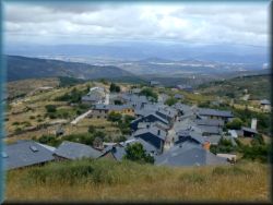
In the
village of Acebo are two bars, shop and three pilgrimage hostels. Parish hostel is recommended,
which is basic, but we have a common dinner
and voluntary contribution. If
the weather is nice, we go together in the evening to see the beuutifull sunset at
the Cross on a slight hill at the west side of the village. The cross is placed in such a way that,
if we stand just on the right place, the sun at sunset is right in the center of the Cross.
Slightly lower, below the village is another modern - tourist accommodation,
which even has a swimming pool.
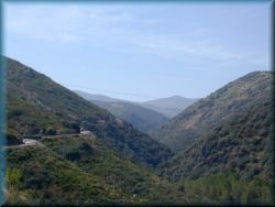
From here we continue for about an hour
along a slightly descending asphalt road to the next village Riego de Ambros,
and from here is a steep descent on foothpath into the valley.
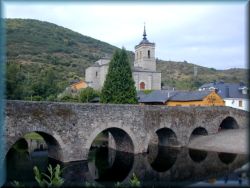
After a long descent, we reach the road in
the valley in the smaller compact medieval town of Molinaseca. At the
entrance is a smaller church, and another larger one, which together with
the bridge is a symbol of this town, is on a slight hill on the left side
of the town. The special feature of this town is a larger arched, stone bridge
over the river. In addition, in Molinaseca are more shops and two larger pilgrimage
hostels.
We leave the
town along a footpath near a flat road, which descends over a slight slope to
Ponferrada, 12 km away. Ponferrada is a modern large city and the capital of the
province of Bierzo, and has a population of 70,000. The monastic order of the
Templars still operates in this city and has quite a few interesting old
buildings, such as castle, churches, etc. As we follow the path along the road
from Molinaseca to Ponferrada, just before entering the town, the pilgrimage
route turns left towards smaller villages. It is recommended not to follow these
signs and go along the road (on sidewalk) straight along the main road to the city
center (this direction is marked as a bike path). If we go there on the left
along the footpath, we will make a big semicircle and lose at least an hour or
more...
Immediately in the center we keep to the left, if we want to stay here overnight, but
if we want to pass the city as soon as possible, then straight through
the center.
In Ponferrada is only
one big pilgrimage hostel. Usually a large
number of pilgrims gather in it, some even camp outside in tents. In addition to
real pilgrims, pilgrims-tourists are also starting to appear here, (ie those
pilgrims, who
walk only a short, last part of the "camino"way to Santiago). These are especially loud,
and make unnecessary noise. From here to Santiago is 200 kilometers.
From hostel to the city center is quite far. It takes a long time to leave
Ponferrada, it takes one hour to get out of the city. Along the way we see some
sights, especially the beautiful Templar castle. You can leave Ponferrada on the
pilgrimage route and walk along the paths on local roads through the smaller
villages to the village of Camponaraya, which is basically still a suburb of
Ponferrada, as the main road sticks all together. However, you can leave
Ponferrada right from the city center on the main road
(on sidewalk)
in direction
to Cacabelos and come to
Camponaraya on the main road from Ponferrada, in which case the route is almost
as
half shorter...
In Camponaraya (at wine store) turn left onto a
footpath, after a short ascent, goes over the highway, then mostly between
vine fields and through small woods to the small town of Cacabelos, 12
kilometers away. Here, as in the whole of this province, older houses have built on the traditional pattern of a black roof and special built-in balconies. We enter the town through a medieval street, followed by
a shopping center. Here it is worth mentioning the museum church of St. Roch in
the center,
where they keep beautiful church statues, that they no longer need. Admission is
free for pilgrims, but a € voluntary contribution is desirable. Especially
beautiful is Jesus on a life-size donkey and St. Peter with keys in front of the
gates of heaven and a cock reminding him of the sin of disown. In the town are
several shops, bars and several pilgrimage hostels, especially the
larger state-based one, which is at the church at the exit from the town. Instead
of the classic bunk beds, they have double rooms lined up in the walls around
the church. Every evening is a pilgrimage Holy Mass in a larger church in
the town (we return about 0.5 km back into the town).
From here we continue on the road to the 2km
distant small village of Pieros, where is a small pilgrimage hostel,
where you can also get common dinner. A little further when we reach the top, we
turn right from road to footpath, continue through the wavy landscape with beautiful
views, among endless vineyards, cherry orchards and through the village of
Villatule de Arriba to a medieval town on the river Valcarce: Villafranca
del Bierzo. Two larger castles reign over the town, and in the center of town is a larger
church of St. James, where is a pilgrimage Mass every evening.
In the town are several pilgrimage hostels, the first larger, the state-based is at the entrance to the
town below, a little further to the left is the next,
the another one at the san.James's church, and the last smaller one at the exit from the
town. Special mention should be
made of the parish-based one of San Nicolas, which is in the town center next to the
Church of St. James. The town has a lively center with a wide street full
of bars and shops. We continue our way over the bridge next to which is the
statue of St. James. On the other side of bridge is a fork and the path is divided
into two parts: the left part along the valley and the right over-mountain part. We
can choose according to our own abilities.
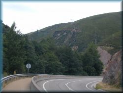
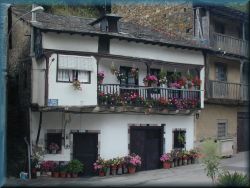
- If you turn left, follow the footpath
near
a fairly busy road in the walley, through the small
villages of Pereje and Trabadelo to the 12 km distant hotel Valcarce, which is
in the middle of the valley Valcarce.
A
little before hotel, joins to this path another one, that goes over the
mountain. This part
of route, in
contrast to the mountain path, is shorter and easily to walk, but it is quite hot in
summer and the air is full of flies, because there is a river nearby. There is
also a highway running through this valley, which goes from the interior of the
country to province Galicia and crosses our path with overpasses several times. The
villages along the way are poor, houses are built in the traditional
way that is typical here in the province of Bierzo. A special feature
of these houses are the built-in balconies. However, all this is in a rather
poor condition and is deteriorating, people have mostly emigrated.
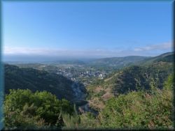
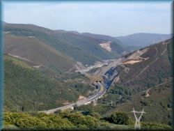
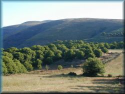
- but if in
Vilafranca we follow the right, over-mountain route,
at the exit from the
Villafranca, follows
one-hour-long
steep ascent to the
ridge, over which two larger
electric power lines pass. In a short time we gain a lot in elevation. When we
reach the top, we walk for a while along the ridge between a sparse pine and
chestnut forest and extensive clearings with a beautiful view to the distance,
to the valley of the river Valcarce and the neighboring peaks. In the last part
is a dense chestnut forest, and on the right is the village of Pradela,
where is also a small pilgrimage hostel and bar. In front of the
village of Pradela, we turn left onto a steep descent into the valley to the Hotel
Valcarce, where it joins the path through the valley. Definitely the path over
the hill is nicer, there is no heat and no flies, but it is longer and takes
more time.
Hotel Valcarce is in the middle of waley
and has a variety of souvenir
and food shops, all at “tourist” prices.
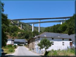
We continue along the local road, through the
small villages of Portela and Abastemistas. The next larger village in the
narrow valley is Vega de Valcarce, where are several shops and pilgrimage
hostels, but they are nothing special. A few kilometers further is the village of
Ruitelan, which also has one pilgrimage hostel, according to other
pilgrims, it is quite pleasant. Above the village, two high viaducts of the
previously mentioned highway with high supporting pillars lead from mountain to
mountain.
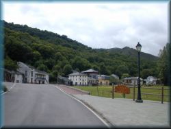
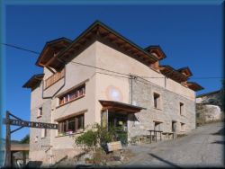
About a
kilometer further we come to a fork, where we turn left and
descend to the rest of the river, where is the village of Las Hereiras. In
this village is a shop, bar and a small, pleasant pilgrimage hostel. In the evening we have a meat-less
common dinner.
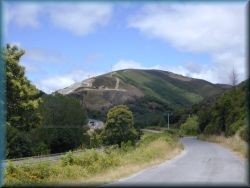
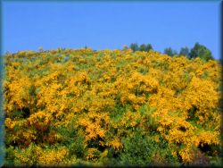
After about
two kilometers, the valley is over, and the winding asphalt road begins to climb
quite steeply into the mountains. The view opens up with the elevation. Once we are
quite high, the pilgrimage route turns left along the footpath to the village of La
Faba. However, it is not advisable to go along this path, as the route
initially descends slightly into a ravine, and then is a steep ascent to
the village of La Faba. It is better to overlook this turn and continue straight onto
the road. After a kilometer we pass to a crossroads where we can turn left
for La Faba, but if we do not intend to stay there, then we continue
straight on the main road for the village of La Laguna. After the next two
kilometers of slight ascent along the road, we reach the village of La Laguna,
which is the last village in the province of Castile. All this last part of the
ascent along the road we can admire an infinite number of yellow flowers on the
slopes of these hmountains and if we are here at the right time (beginning of July),
all these slopes are one fragrant carpet of yellow flowers...

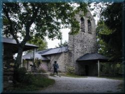
- but if we
decided to we go through La Faba, which is a little lower than the village of
Laguna, then, when we reach the bend where the is the bar, we turn left and go to a rather distant church at the end of the ridge, where is a
Franciscan monastery and a small pilgrimage hostel, run by the Germans. The
accommodation is nothing special, it is a quite place with a basic offer, such
as a shower and overnight stay. Everyone has to take care the food themselves,
but it is awkward, because is no shop in the village,
so this has to be
procured in the valley first.
In the church, next to the accommodation,
is ery
evening a Holy Mass for pilgrims. Our route continues along a fairly steep footpath to the next village La Laguna.
In the village La Laguna, which counts only a few houses is a small pilgrimage
hostel in the bar. From here we go up on a foothpath over an open clearing with a
beautiful view back to the valley and especially to the neighboring peaks...
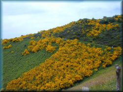
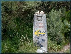
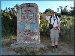
Along the way, however, everywhere is full
of bushes with fragrant yellow flowers. Soon along the way we notice a confin (landmark)
with the inscription 152.5lm ... This is the distance from here to Santiago.
From now on, we will meet such milestones along the way every half of kilometer,
all the way to Santiago. A little further we come to the top to a large
colorful boundary stone, which indicates that here begins a Galicia - the top
north-western province in Spain. Another kilometer of walk and we
arrive on Cebreiro...
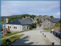
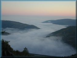
Cebreiro is a small mountain village on the top of the saddle, where in fine weather is a beautiful view
to the
wider surroundings and the neighboring mountains. However, here is often a
thick fog, because hot and dry air coming from the mainland and cold and
humid air from a 200 km distant Atlantic ocean are often mixed here. In this case,
the visibility is barely 10 meters and as we go forward, we see “how the clouds
are made here” and rise under the sky. If the weather is nice, this is one of
the most beautiful places to spend the afternoon and spend the overnight. The
climate in these places is changing considerably: if we have been accompanied by
stable, dry weather and heat so far, we can now expect about 10C lower
temperatures, frequent rain and rapid weather changes. In the province of
Galicia, the
weather is influenced by the nearby Atlantic (the ocean between Europe and
America). However, if the east wind blows from the mainland, there will be no
change and the heat will continue.
In the
village of Cebreiro are several bars, a shop and a larger pilgrimage state-based hostel, which is nothing special. The first thing we notice, when we come
to this village is the unusual music that is played here, as if we were coming
somewhere in Ireland or Scotland - pipes. This is where the Spanish province of
Galicia begins, the inhabitants of this province are of Celtic origin, ie
related to the Scots and Irish. During the period of the Roman Empire, the
Romans often fought wars with the Celtic peoples, who lived in the wider Alps
and attacked Rome several times. They once put an end to this and drove the
Celts (or Gauls) to the far west of Europe, especially to Scotland, Ireland,
French Brittany and the western part of the Iberian Peninsula. Although they
lost their former language, they kept their good and bad habits, including music
and their national instrument - pipes.
>>> Folk music of Galicia >>> (an example).
Their words, especially the names of towns, often contain combinations of
letters "eir" (Negreira, Olveira, Cebreiro, Maceira,...).
An important role in their culture
is caused by the Leon Mountains, through which we now walk, and somehow separate
Galicia from the rest of the Spain.
People in
this province care less about cleanliness and
purity (which we will see
below). The province of Galicia, unlike the rest of the Spain, is quite poor and
neglected. Pilgrimage hostels in this region mostly have completely open
showers so that people can watch each other while taking a shower, so, we have
to use a swimsuit at this task... There is not even a curtain, let alone a door. This
is not in the case everywhere, but such cases are common.
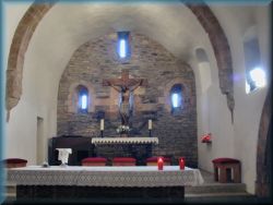
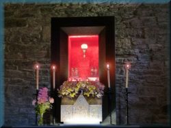
A special
attraction of Cebreiro is the church in which a Eucharistic miracle similar to
the one in Lanciano, Italy, once took place. Once upon a time, a priest who was
massing did not believe, and in his hands the host was transformed into human
flesh and wine in a chalice into real blood. The church is open all the day from
9:00 onwards, and every evening is a pilgrimage Holy Mass and the blessing
of pilgrims. At the entrance to the church is a pilgrimage office where we can get et a stamp, but we can get a new Credencial here too (if we start the pilgrimage
here, so quite a few pilgrims start their journey here, especially the locals).
The church is run by the Franciscans from La Faba.
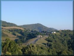
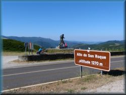
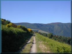
From here,
the footpath ascends slightly through a pine grove, and then descends gently along
the footpath to the road, which is reached by a sharp left turn at the village of
Linares. There is a smaller shop, large pilgrimage hostel and bar. The pilgrimage route
continues from here along the footpaths .... but!
It is best to
go from here on the road, which climbs slightly,
but the pilgrimage route goes far around, and above all,
we get rid of the steep ascent at the end to the top. There is little traffic on
this road. After a kilometer walk along the road, we reach the top of St.
Roque (Alto San Roque), where is the statue of St. James, then path continue along the road to a kilometer away village Hospital, there we
pass village on the
road (do not walk through the village) and along the road we continue the
to the almost three kilometers distant peak of Alto de Poiyo, where is a bar and two pilgrimage
hostels. Here is the highest point of the
route across these mountains and is followed by a laid descent along a footpath
near the road to the 4 km distant mountain village of Fonfria, where is a
larger, modern pilgrimage hostel. Dinner can be ordered at this accommodation
and in the evening the pilgrims gather for the common dinner.
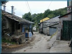
From Fonfria we walk for some time along the
footpath near the road, followed by a fairly steep descent along footpaths
through oak and chestnut forests and many open clearings with a beautiful view
to the valley. Along the way we pass through a few smaller but extremely
neglected villages. The locals here are still far behind..., they have untidy farms,
usually there are piles of manure right next to the houses, often the manure
flows along the path, no one clears anything...
After 12
kilometers of descent, we reach the valley in the larger village of Triacastela.
Before entering the village is a thousand-years-old chestnut tree, that no one
knows how old it is. Triacastela is a larger sprawling touristic village, with many
pilgrimage hostels, bars and shops. In the center of the village is the church
of St. James, where is every evening a pilgrimage Mass. A large number of
pilgrims usually stay in Triacastela, and it often happens that the some hostels
are already full, so it is necessary to try another one. As a destination for overnight
stays, this place is often chosen by those pilgrims who cross only the last 200
or 150 kilometers of the route, which started their pilgrimage only in Ponferrada
or Cebreiro.
At the end of
the village we come to a fork, where route divides into two parts: on the
left, the longer part along the valley through Samos to Sarria and on the right,
the shorter part over the hills to Sarria:
- If we go
left, we walk to the village of Samos, 10 kilometers away, which lies in a basin
in the middle of the valley. Somewhere halfway to Samos, in the village of Lusio,
about 500 meters to the left from the route, is a small pilgrimage
hostel. Before we reach Samos, we see a large Benedictine monastery in the
valley from the road. According to some sources, it is the largest monastery in
the Spain. From here, to the village we descend along a steep footpath and a few last
100 meters along the road to the monastery, where is a larger pilgrimage hostel. The monastery is so big, that it even has its own small
petrol station.
Every evening is there a pilgrimage Mass in the church in the Monastery.
In the vicinity
are several shops, bars and restaurants. This place is often
chosen for overnight stays by pilgrims and cyclists, because it is in a
favorable position along the road and, unlike the Triacastela, it is not so
crowded, so there is still free space.
We continue
for some time along the footpath near the road through the valley, and then we go
along the forest paths to the town of Sarria, about 15 kilometers away.
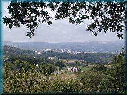
- If we turn right in Triacastela along a
shorter route over the hills, we will have a long ascent along the asphalt road to
the village of San Xil, followed by walking on a local road and partly along
footpaths through forests and open clearings, through smaller villages all the way
to Sarria. The route is 22 kilometers long, where are two pilgrimage
hostels in solitude, the first near the village of Calvor after about
14 kilometers fom Triacastela, and the next is 2 kilometers further.
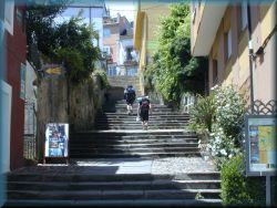
The city of Sarria is 114 kilometers from Santiago. We enter
in its newer part, above which rises on a steep
slope its older part with narrow streets and houses painted with a distinct
white color (which we will then see too in the next town Portomarin). From the lower
part, we ascend to the upper part of the town by long stairs, which are somewhat
similar to Trsat's steps in Croatia. There is a wall next to the stairs painted
with frescoes of pilgrims
on it. At the top we reach the old city center, a little higher is a church with
a small park below and a little higher in the same street is another church
dedicated to Mary of Guadalupe (if we are here just in righe time, we will be able to
meet Indians, who every year 8. of july come here on a pilgrimage from Mexico
and then they dancing and singing in front of the church and then continue that
in all the
way to Santiago). (see the video below under the description of the city of
Santiago)
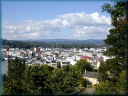
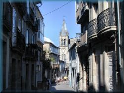
Sarria is
full of pilgrimage hostels, as a large number of pilgrims gather here,
especially those locals, who will start their pilgrimage here, and cross only
the last 100 kilometers to Santiago. From the center, the path ascends slightly
to the top of hill, from where is a beautiful view to the white city, and then
descends to the other side past the Magdalen Monastery with a larger pilgrimage
hostel.
6.) Wavy,
hilly and wooded landscape of Galicia (Sarria - Santiago de compostela)
In this
part of the route will be so many pilgrims on the way and consequently
more crowded accommodation, because most local pilgrims cross only the last
100 kilometers of the route - from Sarria to Santiago. Therefore, in
the last part of the route, a long column of people is usually dragged along
the route.
So it’s getting more touristy here...
The landscape in this part is mostly
forested, there are no more grain fields or vineyards, because the climate is
too cold and too humid.
The rocks in this top-western
part of the Iberian Peninsula (and Europe) are composed mainly of light
bright granite with large quartz crystals. We often find large stones
of pure quartz along the way. This granite
is not of volcanic origin, but is part of the ancient continental earth crust,
which is one of the oldest rocks on the earth and was formed soon after the
formation of the earth. The earth in this part of the Iberian Peninsula is
not geologically active and has been preserved throughout
history to the present day. Granite is good for walking, and although it is
wet, it is not smooth due to its sharpness, so shoes (and tires) do not slip on it.
The soil in this landscape is darker
in color with a high content of fine quartz sand, which due to its high
permeability to water almost completely prevents the formation of mud, and
if it does, it is not greasy at all and does not stick to shoes. However,
this soil is too permeable to water and cannot retain moisture, so it dries
out too quickly and the crops grow poorly. As a result, the landscape is
quite barren, the land is not so fertile, so there are no major fields here. In
cases of major drought, practically nothing grows here except tall trees.
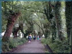

When we
leave Sarria, we walk along the foothpaths and local roads near the railway, then
climb through the forest to the small village of Barbadelo with several
smaller pilgrimage hostels. The landscape is hilly with small villages
and individual farms, along the way. This is followed by a few hours of walking
along footpaths and local roads, through the wavy landscape with many slight
ascents and descents through smaller villages and chestnut forests and other
deciduous forests, and in general the path rises a bit quite. Finally we
reach
the top
of the hill with bar, a little behind is a hidden pilgrimage hostel
Ferreiros. At the top of
Ferreiros is a bar and another larger hostel. The second, state-run hostel, is
hidden behind the bar to the left. The accommodation is new, in a quiet,
peaceful place and close to the forest, in the nice, quiet place...
After a kilometer of walk we reach
an important milestone on the way, which indicates that Santiago is
only 100 kilometers away. Years ago, the goverment re-measured this
route with modern devices (GPS) and found that this part of st.Jeams route is about 10 km longer, so
they moved most of the milestones along the way. This one, 100 kilometers
long, was moved 5km further.
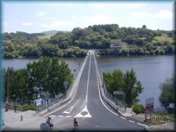
From here
follows a laid descent along the local road through smaller villages. In
the valley we see a lake and above it on a hill is a white town Portomarin. The
last part of the route we descend along foothpaths to a long bridge over
the lake, along which
float
even smaller boats.
We cross the bridge and climb the
steep stairs to the town. The town center is represented by a wide street,
which often houses various events and markets. In the center of the town
stands a large stone church of St. John, in appearance quite similar to a
fortress, and is one of the buildings is from the old town. Originally, the
town of Portomarin lay much lower in the valley where the lake is now. In
1960, a dam was built for the power plant, flooding a wider area of the
longer valley, and the ctown was rebuilt on a hill above the lake. The
original church and a few other important buildings were dismantled and
transported in parts (stone by stone) to the present place and re-assembled
here (built from the same material and the same pattern, in the form of a
fortress). The rest was demolished and a new city built from the remains.
In the town are several pilgrimage hostelss, shops, bars
and restaurants. In
Portomarin, just as in Sarria, a larger number of pilgrims gather, and
therefore there is usually a considerable crowd in the hostels and bars.
We
descend along a wide street to the lake and cross the lake over another
bridge, then ascend along a footpath through the woods to the road and along a
footpath near the road, that climbs more or less through a slightly undulating
landscape and through pine-chestnut forests, through smaller villages, which
all also have pilgrimage hostels. Special mention should be made of
Gonzar, about a two-hour of walk from Portomarin, where is a small
hostel on seclude, and near the hostel is a bar-restaurat. After 17 kilometers of a more monotonous
walk along a slightly ascending road and foothpaths in the forest, we come to a village of
Airexe, where is pass, then route slightly
descend
towards the town of Palas
de Rei.
Here, on
a pass in the woods we notice a big change: the trees in these forests are
tall of
unusual, narrow trees with narrow, pointed green leaves and falling
bark, and below, new bark grows - these are eucalyptus trees. Young
eucalyptus trees, on the other hand, have broad, light blue leaves that, if
crushed, smell strongly of menthol and of some creams. Eucalyptus trees grow
where the climate is humid, not too hot and does not freeze, ie. in the
vicinity of the oceans. The entire top-western part of Spain and
Portugal is overgrown with eucalyptus trees.
Eucalyptuses are used for wood, firewood, and from the leaves they produce a
special oil for various creams and teas. There are also many plantations
where they are systematically afforested with these trees, which grow well
on the barren land here.
About a
kilometer before the town of Palas de Rei is a small pilgrimage settlement
with a larger pilgrimage hostel and shops, in order to keep at least
part of the majority of pilgrims before the town (especially those who
walk only the last 100 kilometers, because they are relatively rested and
sometimes cause various inconveniences). After about a kilometer, we
arrive in the Palas de Rei. It is a compact town on a hill. At the
church we descend into the town.
In the town
are several pilgrimage hostels and
shops, otherwise is nothing special. A large number of pilgrims
usually stay here for overnight.
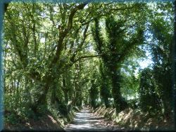
We
continue along the footpath, which descends slightly through chestnut, oak and
eucalyptus forests into the valley to a small bridge, next to which is one
of the better, smaller pilgrimage hostel Ponte Campanja.
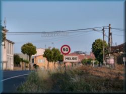
The path
then climbs abruptly past Mato-Cassanova to the village of Leboreiro, where
a landmark reminds us, that we have reached the province of A Corunja, which
is also the capital of the province of Galicia, but we will not go there.
From here we follow the footpaths through the forest, mainly along the
plain near the road to the town of Melide, 8 kilometers away. The town has
some pilgrimage hostels, shops and a church. A special feature is the
church on the hill, not far from the pilgrimage hostel, where is often
a Holy Mass for pilgrims at the evening. In the altar of this church is Mary with three
angels. We still have exactly 50 kilometers to walk to Santiago, well, after
the new count 53...

We
continue our way through a rather undulating landscape with many slight
ascents and descents through mainly eucalyptus and partly chestnut forests
and through a few small villages to 15 kilometers distant larger modern city
Arzua, which is the last city before the Santiago. This city is
full of pilgrimage hostels, shops, pilgrims, tourists, noise and everything
else ... So there really is no good reason to stay here, it’s better to
move further.
Next we
follow on the footpaths, mostly through the forest and after 16 kilometers we come
to a village near the road: Salceda, where is the first next hostel.
In between, in the middle of the forest in the village of Calzada,
where is a bar with a small shop. From Salceda we continue walk on about 6
kilometers along footpath, which goes mostly near the road to Santa Irene.
In fact, it is just a small hamlet next to the church of St. Irene. Just a few hundred meters
away, along the road is a pleasant small pilgrimage
accommodation Santa Irene, where pilgrims also have access to the kitchen.
There is an even smaller bar and a camping area. We have
only
a 23 kilometers to Santiago. This place is a great starting point for tomorrow
when we get to Santiago. From here is only 23 kilometers to Santiago and if we
start at 6:00 am, we arrive in Santiago in time to put the backpack
on deposit and attend the pilgrimage Holy Mass at 12. In addition, we
avoid the crowds of pilgrims - tourists, which are in the next, 3km distant
town of Pedrouzo.
From here,
the path slowly descends to the 4 km distant village of O Pino, and soon you
come to a road and a fork: turn left into the tourist resort of Pedrouzo.
In fact, it is just one longer street of compact newer houses and
hotels, a little further on the left is the old village center of
Arca, next to the church, where every evening is a pilgrimage Holy Mass
in Italian and Spanish.
In
the town
are a large number of pilgrimage hostels, because a larger number of pilgrims usually gather here
for overnight.
First, the state-based pilgrimage hostel is right at the entrance to the town,
on left side.
However,
if we do not want to stay in that town and would like to move on as soon as
possible, some 500 meters earlier, at the tfork in the village of Pino, we
go straight across the road along the marked pilgrimage route and follow the
shortcut behind the city on footpath through the forest. After about eight
kilometers of walking along mostly forest footpaths and local roads through the
undulating landscape, with many short ascents and descents, through smaller
villages, we reach Santiago Airport, and then the RTV center to
a small hill above the Santiago - Monte del Gozo. At the top, we reach the chapel
of St. Mark, and next to it is a large monument to the former
in 1989, when
Pope John Paul II was here, when the
World Youth Meeting was held here.
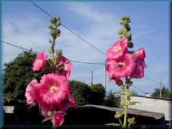
A little further on, lower in the
direction to Santiago, is a larger tourist accommodation center, which is
slowly deteriorating. The upper part, number 29, is reserved for pilgrimage
hostel, so we can spend the night here, and every evening is a
pilgrimage Holy Mass in a chapel two hundred meters backwards, at the
monument. From the monument is a beautiful view of the surroundings,
the city of Santiago and the large Cathedral of St.James in it.
7.) Santiago de compostela
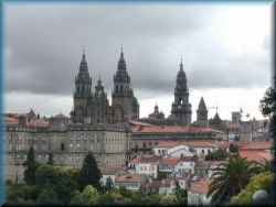
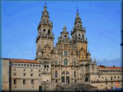
We descend
into the valley, cross the bridge over the highway, then we see a local sign, with
the inscription Santiago ... First part is of the city is new, modern part of the city, with various
highrway intersections, a little further, on the hill is the old part of
Santiago. One hour of walking around the city, and we reach the Cathedral, which
is in the old part of city. At the beginning of the city is one
pilgrimage hostel San Lazaro, but I do not recommend it because it is too
far from the center and it still has poorly maintained toilets. Further
along the route are even more pilgrimage hostels and the most recommended is
pilgrimage hostel Seminario menjor, which is about a 15 minute of walk from the Cathedral.
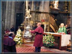
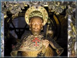
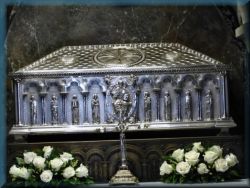
Every pilgrimm who comes to Santiago,
first goes to the Cathedral, then finds suitable accommodation, puts down the
equipment and returns to the Cathedral (but if we come here in the morning, we
hand over the equipment (backpack) to the deposit behind the Cathedral), In the
Cathedral is
in a crypt buried apostle St. James. Every day, at noon
is
in the cathedral a pilgrimage Holy Mass.
Before the mass, they read the statistics of pilgrims every day and list the
number of pilgrims by individual countries, where we came from (of course, they
mention us only after we have picked up the certificate at the pilgrimage office).
A special attraction in this church is the large incense burner, which is
tied to a rope under the ceiling and is so large, that it has to be powered by
ropes through a special mechanism by as four to eight monks. The incense burner
swings across the front of the church here and there. (watch the movie).
As a rule, it is run only on Thursdays at noon mass, and sometimes in addition
to other times. There is no exact schedule, this is determined by the priest.
>>>
Great botafumeiro - incense burner- smoking >>> (film)
.
In the altar is a statue of St. James, and below is a crypt, where
is buried in a silver coffin
the apostle St. James
the Elder, who preached his teaching in this part
of the world after Jesus left. (Iberian Peninsula). After a few years he
returned to Jerusalem, where King Herod had him beheaded. His body was then
transported by boat, by two of his disciples to the port of Padron, which lies
about 45 km southwest of Santiago, and then buried there, and the disciples are
also buried next to him. Later, a church and convent were built on the site, and
slowly grew around it the large city of Santiago de compostela, which currently
has almost 100,000 inhabitants.
Santiago is
known around the world for this pilgrimage route, which began as early as the
Middle age, then died out for a while, most recently, especially after the
visit of Pope JPII. in 1989, more and more pilgrims from all over the
world are on the way. The cathedral and other ancient buildings in the city
and its wider surroundings are built of granite, that is, the hard and durable
stone that Galicia has in abundance.
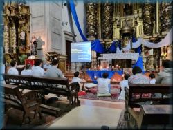
In addition
to the Cathedral, are several other attractions in the city, in front of
the Cathedral is a larger square, where are various events, pilgrims
gather, and live music (on pipes) by the church during the day. In
the city are several other churches. And let's not
forget to go to the pilgrimage office, which is not far from the church, to get
a certificate of pilgrimage.
Various events and concerts often take
place in the vicinity of the church in the afternoon and evening, or pilgrims
prepare something for themselves.
However, if we are here around July 25,
when St. James celebrates, then we go to the main square in front of the
Cathedral on the evening of July 24, where is a fireworks show at 11 pm.
We have to be on the square until at least 9 pm, otherwise we can't get there
anymore due to the big crowd. The show lasts just under an hour.
>>> Indian
dance 2 >>>
(film - a
group from Mexico that roams Calvor - Sarria - Santiago every year)
.
>>>
Indian dance 1 >>>
(film - a
group from Mexico that roams Calvor - Sarria - Santiago every year)
.
>>> Presentation and fireworks 24. july >>> (film
- presentation on the eve of the feast of St. James)
.
>>> Parade with folk
music >>>
(film -
procession of musicians to the feast of St. James)
.
>>>
National music - Galicia >>>
>>
(film - a group of musicians plays the folk music of Galicia)
.
>>>
Pigrims singing and dancing >>>
(film - a
group of pilgrims singing and dancing in the front of church)
.
A little further from the center are
bus and railway station, and 10 kilometers outside from the city is airport.
.
8.) Way
to the end of the world, to the Atlantic ocean (Santiago - Finistera - Muxia)
This part
of the pilgrimage route starts at the Cathedral of Santiago and is a
approximately
90
kilometers long to Cape Finistere and an additional 35 to Muxia.
Finistera is the most western continental point of Europe, western of even Great
Britain and Ireland (except Iceland of course). In Muxia, however, is the
famous Church of Mary at the Atlantic coast.
At Santiago Cathedral, we go down
along the
street, past the police station and follow the signs. When we get out of the
city, we
turn onto a footpath and partly through eucalyptus forests, partly through
smaller villages we walk to the town of Negreira, 25 kilometers away.
Somewhere in the first third of the route we come to a more populated valley
around the town of Ames, we walk along the road for a while, followed by a
longer, steep ascent to Trasmonte.
Then laid
the descent into the valley, over the bridge Ponte Maceira, over the river on which
is a small dam, then after a few kilometers of walking along the plain we are in
Negreira.
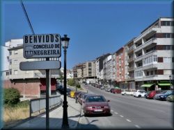
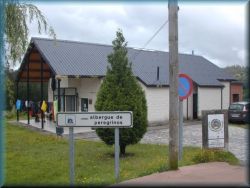
Negreira
is a town with several pilgrimage hostels and shops. The most famous
is the "municipal" hostel (state-based), just under a kilometer away from the city,
left by the road. The accommodation is small, only for 22 people, and is built
entirely of light granite bricks.
On this part of
route
are only a few pilgrims, as most of other pilgrims do not continue in
Santiago.
In the hostel
is a kitchen, so we
can prepare our own dinner. Since the accommodation is a bit further from
the city center, it is recommended, to buy food on the way in the town
centre, so that you
don't have to go back. If it's not too late, we can continue, because it's not
too far to the next accommodation, but
we have to stamp a pilgrimage booklet
somewhere in Negreira ,
preferably in some bar.


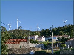
Route
continues past the church and climbs on the footpaths, through the eucalyptus forest,
through smaller, poor villages and through open clearings. After two
hours of walk, we reach the top of Alto de Pena, where is a small village
Piaxe, with
a church, bar and two smaller pilgrimage hostels, where is also
possible to get a common dinner. However, there is a nice place, because is
calm and a good view of
the surroundings. Wind poweplants are spinning on the hill above the
village.
After an hour and a half of walk, we
arrive in the next village Villaserio, where are two smaller
pilgrimage hostels. People in this part of country are mainly engaged in
agriculture and livestock breeding. Due to the humid climate, the grass in
this environment does not dry at all, but is processed into silage. Therefore,
an unpleasant sour smell spreads around these farms, instead of a pleasant
smell of dry hay.
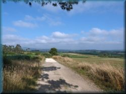
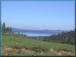
After a
further three hours of walking, we arrive on Monte Aro, from where we see a
large blue lake in the valley. No, it's not the Atlantic ocean yet, it's
just a lake. A little further on te path is the village, also with a small pilgrimage
hostel and bar.
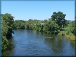
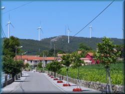
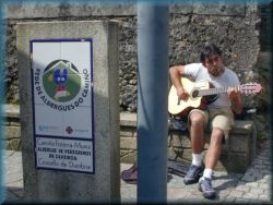
Finally,
our route descends along the road into the valley, to the Ponte Olveira bridge
and after a few kilometers to the village of Olveira, above which is hill,
sown with the wind powerplants.
In
the village
are three pilgrimage hostels, the "municipal" (state-based) is cheap and has a kitchen. Otherwise, it is
not exactly too clean, it is full of flies, often absent manager, poor
sanitation... If it's not so late, we can continue walking, but
we have to stamp a pilgrimage booklet
somewhere in Olveira ,
preferably in the Casa Loncho bar.
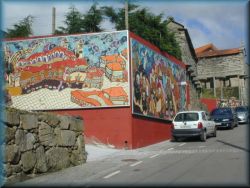
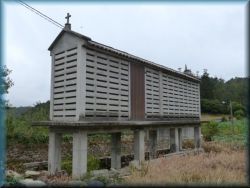
Here is
also a shop and three bars. A special feature of the
villages in the province of Galicia, are the special "chapels"
next to almost all the village houses. These are small snacks placed on
stone pillars, which sometimes served as storehouses for corn, grain, and
other crops, because the pillars made them inaccessible to mice and are airy
enough that the grain did not spoil in this humid environment.
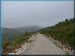
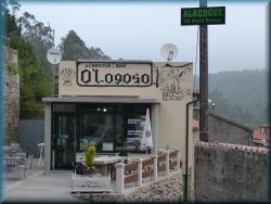
From Olveira, we ascend along a footpath
to a hill,
sown with
the wind powerplants, and go along a
footpath above a narrow valley
with a dammed river for a smaller power plant. After one hour we arrive in
a secluded village on the slopes - Logroso, where is pilgrimage hostel an
bar. We soon reach the top, but a little earlier is a new light yellow building along the way, where is a tourist/pilgrimage
office, where we have to get a stamp (without this
stamp we will have problems in Finisterre (and/or Muxia) in proving our
walking, and us in the state-based hostels they refuse, and what's worse: we don't
get a certicicat of this part of route,
At the top is the village of Hospital, is a bar, and about half a kilometer further we come to a
roundabout where we have to decide where to go first: either to Finisterrre or
in Muxia. To Finistere is 35, and to Muxia is 30 km. Not so far away on the ridge is
thermal power plant and several wind powerplants.
- if we
choose the right route, towards Muxia, we walk near the wind powerplants, partly along the
footpaths, partly along the road. One
kilometer before the village Dumbria, is a new pilgrimage hostel, that was opened in the
village of Concho a few years ago. Just a few hundred meters before
we reach this hostel, is a stamp in the valley near a house by the
pilgrimage path outside, with which we have to stamp the pilgrimage booklet.
From the Dumbria, our route climbs into the eucalyptus forest and for a long time we
walk along a lonely footpath through the dense eucalyptus forest, through small
villages and past individual farms to the other side of the hill, where we
descend to the sea - Atlantic ocean, and then is another hour's of walk along the coastal
road. to the village of Moraime, and from here over a small
hill, where is the church of St. Roch, to the town Muxia.
Just
before the town, we reach the sea (Atlantic Ocean). To enter the town,
we go along wooden footbridges above the bay with a sandy shore. Here we
come into the town of Muxia.
This route to Muxia is quite lonely,
on the way are only
a few houses, and we usually don’t meet anyone.
On this part of
route is
no major view anywhere, as we walk through the
forest almost all the time.
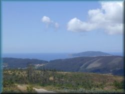
- However,
if we turn left towards Finisterre at the roundabout, on the ridge at the
previously mentioned thermal power plant, we will have a slightly longer,
but much more varied route, where we will meet more people. We walk
about a half of kilometer along the road, then turn right and descend slightly
along the footpath, partly through a sparse pine forest of shrubs and eucalyptus
trees, and mostly we walk through a fairly open landscape. In the first
part, the path is a bit more varied with a few minor ascents and descents,
and in the last part it is almost completely flat. We finally get to the
saddle, where we have a unique view to the lowland, to the wide blue ocean,
the city of Cee below, the wide Atlantic coast and the
Finisterre peninsula. All the surrounding peaks are densely sown
with wind poweplants.
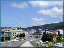
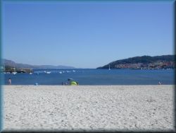
From here
follows a fairly short and steep descent along a poor, rather rocky footpath
into the lowland to the town of Cee. The town of Cee is a smaller,
rather sprawling town along the main road by the sea bay, at the Atlantic
ocean.
In the center of the town is a beautiful sandy beach by the sea, but
the appearance is sometimes deceiving. This beautiful sand shines strangely
somewhere, as if it were varnished ... If you walk barefoot on it, you feel
its sharpness, as it is quartz sand in the form of tiny needles, which is
not suitable for lying on the beach. In addition, the water in this bay is
quite polluted, cold and
on the beach
are often decaying algae. In the
town are several shops, pilgrimage hostels.
In the town
Cee is
pilgrimage route poorly marked.
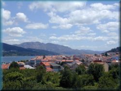
We leave
the town of Cee along the coastal path in a western direction and when we
reach the main road, we just cross it, and go right into the town of
Corcubion, which basically sticks to the town of Cee. The path
ascends along a narrow street, then we turn steeply right onto a footpath, that
goes under the forest, above the town.

After two kilometers of ascent, we
come to a small village, where is a little further on a saddle, than we come to
the main road. Here we see on the left, slightly from the road, an
older building in a low stone fence. This is a smaller
pilgrimage
hostel San Roque, one of the better ones along the way. It doesn’t open
until 4pm. Entry rules are strict; if we happen to be missing a stamp from
Negreira or Olveira or pilgrim office in Hospital, we have nothing to do for here... This is basically
the only “parish” accommodation in Galicia, which runs by an elderly couple. The
accommodation is secluded and we have common dinner in the evening. To
shorten the time, they have a special 2 meter picture on the table for
assembling from pieces (puzzle). The picture is getting a little bigger
every day...
From here is a beautiful view to
Cape Finisterre, where we arrive tomorrow.
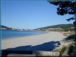
From here we descend along the road to the village of
Sardineiro, and then to the right, about a kilometer along the footpath through the forest
above the village. Finally, we descend to the white sandy beach and along it
all the way to the town of Fisterra, where we go into the center.
9.) Finistera - Muxia
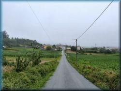
A
32-kilometer route awaits us. From the center of Fisterra, we go back
two kilometers
along
the main road to the village of Sv. Martin, where at a
major intersection turn left and continue along the local road through smaller villages.
At the signs, turn onto the footpath and walk partly along the unpaved roads and
footpaths through the eucaliptus forests to the larger village of
Lires. Nowhere is there any major ascent, and just before the village we meet
pilgrims those walking in the opposite direction from Muxia towards Finisterre,
otherwise the whole route is lonely and we meet almost no one on the way. We
mostly walking through the eucalyptus forest.
We arrive in the village of Lires at the
church of S. Esteban, and a little further is outside a stamp,
with which we have to stamp our
pilgrimage booklet (a notice
is written). The path rises into the village. Here we can go to the red bar "As
Eiras", where is also a pilgrimage hostel.
It is also recommended to stamp a booklet
here , because in Muxia
are quite accurate, and we have problems if we do not have stamps from here (we
cannot sleep in a state-based hostel and they do not give us a certificate of
pilgrimage!).
The path descends to a larger stream and
then slowly climbs on the hills. There are almost no more settlements in this
part of the route, here are only a secluded small farms, and almost all the time
we walk through eucalyptus forests.
In the last part is a slightly larger ascent and then a fairly steep descent to
the road, along which after two kilometers we reach a beautiful sandy sea bay on
the left, and a little further is the town of Muxia.
10.) Muxia - Finistera
A
32-kilometer route awaits us. We leave Muxia along the right road by the
sea (the sea must be on our right!) We walk along the road for about two
kilometers, then we turn left onto the footpath and after a steep ascent we come
onto the hill.
We walk through eucalyptus forests, there
are no larger settlements along the way, only here and there is a house or a
small farm. A
gentle descent follows and when we cross a larger stream, is a short ascent
to the village of Lires. Here we go to the red bar "As Eiras", which is
also a pilgrimage hostel too. We must
stamp the pilgrimage booklet here
, because in Finistere
are wery consistent, because if we don't have a stamp
from Lires, we have nothing to do in the state-based pilgrimage hostel,
nor do they give us a certificate of pilgrimage!, they simply dismiss us in a
quick procedure. The path descends to the church of S.Esteban,
where is another stamp outside
and a notice that we have to get a stamp here again.

A little further from the village we
meet pilgrims, that going in the opposite direction from Finisterre towards Muxia,
otherwise the whole way is lonely and on the way we meet almost no one. We
continue along footpaths and unpaved roads through the undulating land and
eucaliptus forest landscape
through smaller villages all the way to the main road, which we reach at the
village of Sv. Martin. From here to the town of Fisterra is 2 km of walk
along the main road (or a footpath along the sandy shore). In the town Fisterra we go to the
center, next to the bus station.
11.) Finisterre
In the town of Fisterra we go to the
center, where is a bus station, and a monument.
It is only a few ten meters to the coast. The state-based pilgrimage hostel is
right next to the bus station, and it opens at 13:00, here we also get a
certificat of the pilgrimage to Finisterre (on the morning time in the tourist
office). Upon enrollment, they are very consistent and strict, checking stamps (from
Santiago!, Olveira, Negreira, Lires, checkpoints, hostels...). If we
miss any of them, they will not accept us here, nor will they give us a
certificat of the pilgrimage to Finisterre. In that case, we are left to spend
the night in one of the private pilgrimage hostel in the town,
or we can choose on one of them earlier, and go to the state-based only to get a
certificate. The certificate is similar to this one, that we get in Santiago or/and
Muxia. Such a
strict procedure was introduced, because some pilgrims had previously abused
cheap pilgrimage accommodation, even though they did not come here on
foot, but were take a bus, or at least part of that route. Now the checkpoints
are where are no bus routes (Olveira, Hospital at the fork, Lires,...)
Once we settle in and put down our
backpack, we have time in the afternoon to explore the surroundings. The town of
Fisterra lies along the Atlantic coast, on the inner side of the bay, so
here are no
major waves. Along the coast is a large square with many bars and
restaurants. Town has
a large number of pilgrimage hostels, bus station, post office and shops.
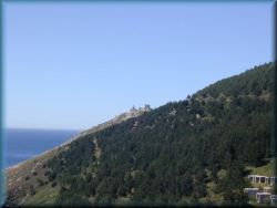
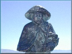
The real "finistere", is the cape,
where is "the end of the world", it is less than one hour's walk along the footpath,
near the road. First, when we get out of the town, is on the right side a small church,
route is followed by a three kilometers long footpath near the road to the cape. The
road is quite on higher elevation on the slope and has a beautiful view to the dark blue sea
and the whole bay, all the way to the town of Cee and beyond.
Somewhere in
the middle of the path is a life-size stone statue of St. James.
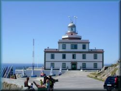
At the top we
come to a parking and stalls where they sell souvenirs and various food, a
little further is the last landmark of St.Jeams way, with its 0.00 km. Three buildings
are here: one
smaller is a bar at the bottom, obowe is hotel, and a little further is large lighthouse, which is a symbol of Finisterre. The
lighthouse stands on the building that houses the museum. Admission is free,
only voluntary donations are collected. The museum was closed a few years ago,
but how it will be in the future is unknown...
In this
museum, they present beautiful, hand-painted pictures on the theme of seafaring.
Here we also get a stamp from the "end of the world" (fin de la tierra).
However, if the museum is closed until a further notice, they have a stamp of
the lighthouse "Fin de la tierra" (end of the world) in the
O Refuxio
bar , which is below, just in front of the Hotel O Semaforo.
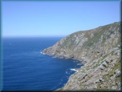
From the
lighthouse we can go a little further, down between the stones.
Pilgrims used to ritually burn a piece of their pilgrimage equipment here, but
now this is forbidden, and the stones are still black here, and small
(non-dangerous) green lizards jumps on them.
From here is a beautiful view to
the Atlantic ocean - the endless wild ocean, that surrounds us on three sides. There is
no way forward, we can only go backward... We are on the top-western point of
Europe and
in the Middle Ages (before the discovery of America) people thought, that the
world ends here... The sun is here so lazy,
so in summer (25 Jun) it sets a little after 10 pm and rises a little after half past
eight in the morning.
We are quite high on the cape, almost 100
meters above sea level, to which steep precipices lead. The sea waves are striking into
the rocks with wild, sparkling waves, so we probably won't even think about
swimming on it... This coast in the wider area of the western Galicia is called the "Costa
da morte" (coast of the death). Numerous shipwrecks have often occurred in this area
in the past due to the wild sea and underwater cliffs.
Then we return into the town. If the
weather is clear, let's not forget to go back to the cape (or on the
beach Fora on the western side of the town) in the evening!, where the pilgrims have a
kind of ritual watching the sunset - the end of the pilgrimage. We siting on the
rocks by the lighthouse and watching the red sun, which slowly sinking into the water. The last
moments on the cape are special and interesting, because we are about 100 meters
above sea level and the sun is lower, than we get the feeling of it shining from
the bottom to up... Some pilgrims singing, others claping,... Soon after sunset they
turn on a lighthouse, and we return into the town. Although the hostel closes at
10pm, we can enter as each pilgrim gets a code to open a door that is locked
with an electronic lock. (at least in a state-based hostel it is so). However, if
for us is too far to walk in the evening to the cape, we can go and watch the
sunset on the beach Fora, which is over a small hill on the western side of the town
Fisterra.
12.) Muxia (pronounced Mushya)
If you come to the town from the
direction of Finisterre, at the first intersection in the town, turn right and
climb to the pilgrimage hostel, which is on a hill, at the end of the upper street, slightly
above the city. However, if you come from the direction of Olveira, as soon as
you get to the town, turn left and climb up to the hostel, which is in a concrete
building, at the top of a steep street. The hostel opens at 1 p.m. We drop off
the equipment here and if we have all the stamps, that are Lires, Olveira,
Negreira, Santiago, control checkpoints,... (same as in Fisterra), we can stay here overnight and get a
certificat of the pilgrimage to Muxia,
similar to that we get in Santiago and Finistere. The hostel is new and spacious, and
there is also a kitchen available for pilgrims. At the top is an open
terrace for socializing in the evenings. However, in addition to the state-based
hostel, there is another private, one slightly lower and another one in
the town center, when they are not so strict about stamps...
After completing the formalities, we
descend to the town along the short street. Muxia lies on a narrow peninsula in the
top northwestern part of the Iberian Peninsula, and is known for the
Church of Mary on the Atlantic.
Above the
town is a small hill, Monte Corpinyo, and behind, on the rocky shore at the top-end of the peninsula, is the aforementioned Church of Mary "La nostra Seniora de
la barca" or La Virxe de la barca (Mary, queen of sailors).
According to
a legend, this place was an ancient Roman town with the port, and once to
around year 40, Mary visits here apostle St Jakob. She arrived here from Judeah with
a merchant ship.
In 1544 a
small church dedicated to Mary was built here, and the present church was built
in 1719. Now this church is quite visited, there are a lot of tourists and every
Saturday is here a larger number of weddings. Every evening is here a Holy mass,
sometimes (on Sundays) at noon to. On Christmas Day,
2013, due to defects on the electrical system was a fire, which burned on the altar,
burnt the roof and altair. Until now, they have restored a new roof,
instead of the altar on the wall is painted image of it,
instead
of a picture of Mary in the altar, is now a statue of Mary with angels on
the ship,. (2019).
They restored a few models of ships in glass cases, and around the statue
of Mary they painted the altar. It is
expected, that this is only temporary and they will eventually restore everything to
its original condition in the future.
In the
church are some models of boats under the ceiling.
After the Holy Mass, we can go to the
sacristy, where they sell souvenirs and we also get a stamp of this church.
In front of the church, on the Atlantic
coast, are large granite rocks, into
which
striking the wild waves of the Atlantic Ocean. The difference
between high tide and low tide is here more than 2 meters. The rocks are black due to
a tanker accident, that happened nearby in 2002, when volunteers from all the
Europe helped clean up the coast. A little above of
the church is a monument to this event in the form of a half-broken stone pillar.
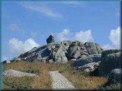
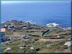
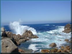
In the town is
another, parish church, several shops, a bus station, with direct bus-lines
to Santiago, Negreira and Finisterre, several shops and a tourist office. We can also climb on the Monte Corpinyo, hill along the
footpath from the
the Church of Mary, and from here is a beautiful view to the town. At the
bottom right we see some remnants of labyrinths, these are a remnants of an
ancient roman town from history. The weather in this part is very unpredictable, often
is here
fog, suddenly attracts over the ocean, but if it is sunny, is wery
beautiful on the rocks at front of the church and due to the reflection of
sunlight from the sea and rocks we quickly get a very pronounced red color if we
stay here too long...
(november 2021)
(I have done this route 5 times)
Skupaj - ogledi vseh strani: